Changbai Mountain Tour
- Chinese name: 长白山风景区
- Foreign name: Changbai Mountain Scenic Area
- Location: Chibei District, Antu County, Yanbian Korean Autonomous Prefecture, Jilin Province
延边朝鲜族自治州安图县池北区 - Climatic conditions: temperate continental mountain climate
- Opening hours: May 1-September 3, 07:00-17:00; September 4-April 30, 08:00-17:00; May 1-September 3:
- Changbai Mountain North Slope Scenic Area: 7:00-17:00,
- Changbai Mountain West Scenic Area: 7:00-15:30;
- Attraction level: AAAAA level
- Ticket price: 199 yuan (North Scenic Area ticket + eco-car)
- Famous attractions: Changbai Mountain Tianchi, Changbai Waterfall main peak Baitou Mountain
- Suggested play time: 1-2 days
- Suitable season to visit: summer and autumn are the best, winter can be skied at Changbaishan Railway Station
Changbai Mountain
Experience the Majestic Beauty of Changbai Mountain in Winter
A Winter Paradise
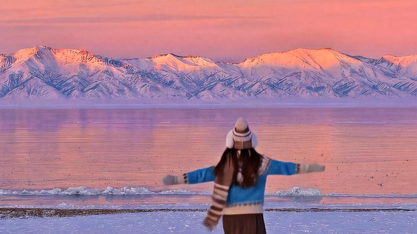
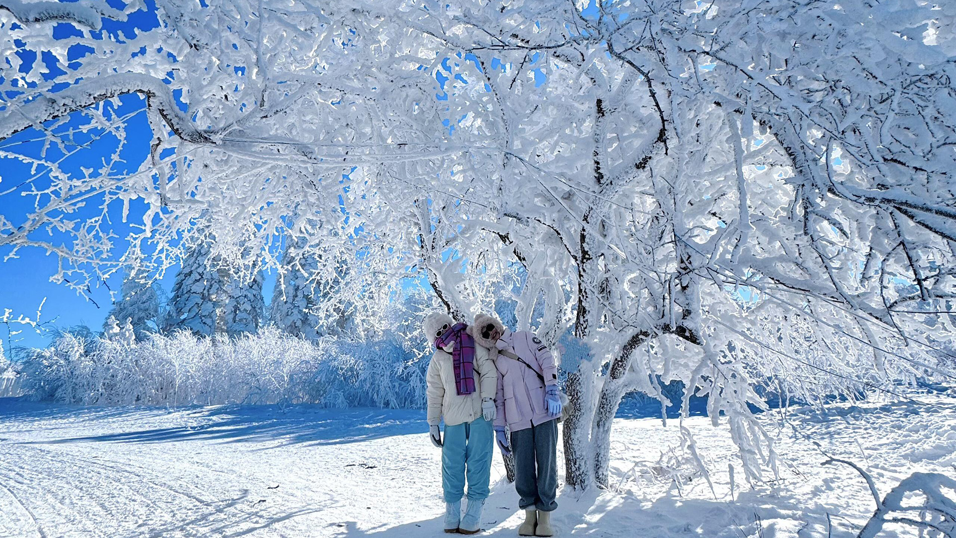
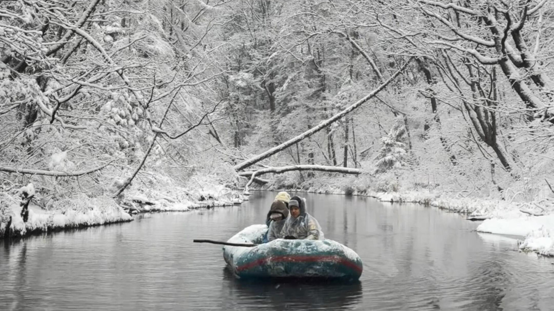
Changbai Mountain, located in the northeastern region of China, is a breathtaking destination that transforms into a winter paradise during the colder months. Known for its pristine natural beauty and the iconic Heaven Lake, the mountain offers a serene and awe-inspiring escape for nature lovers. The snow-covered landscapes, frozen waterfalls, and vast forests create a magical setting that captivates every visitor.
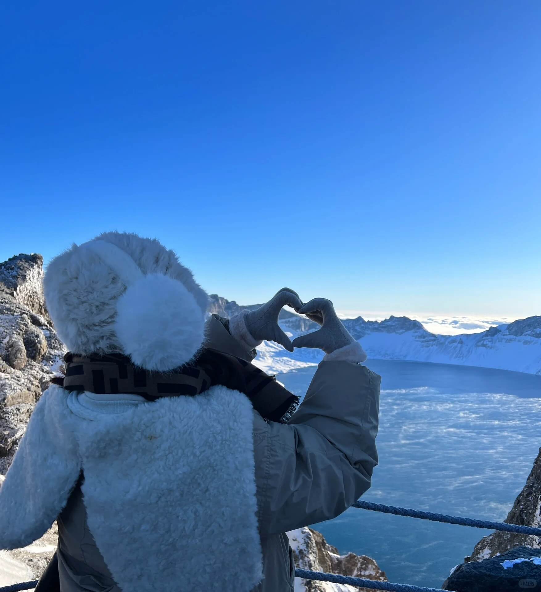
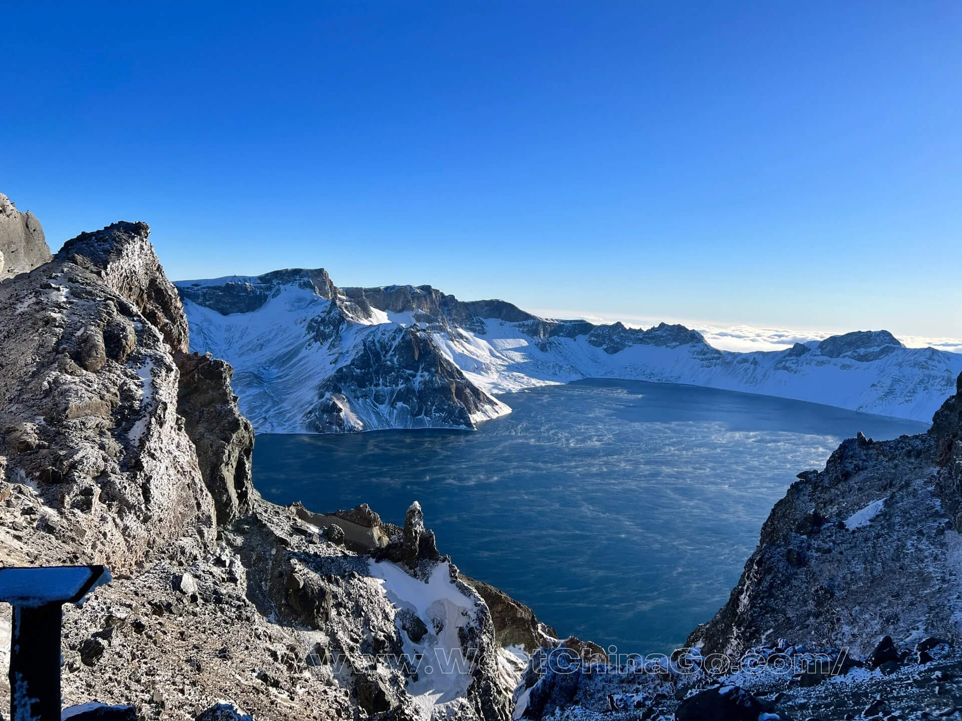
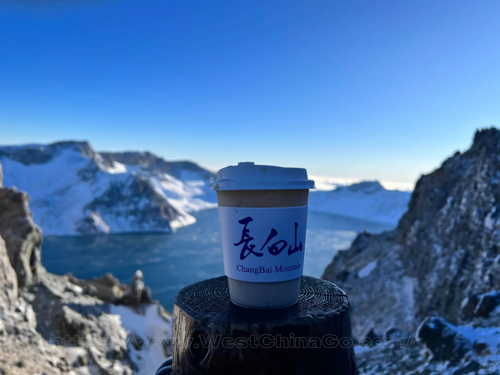
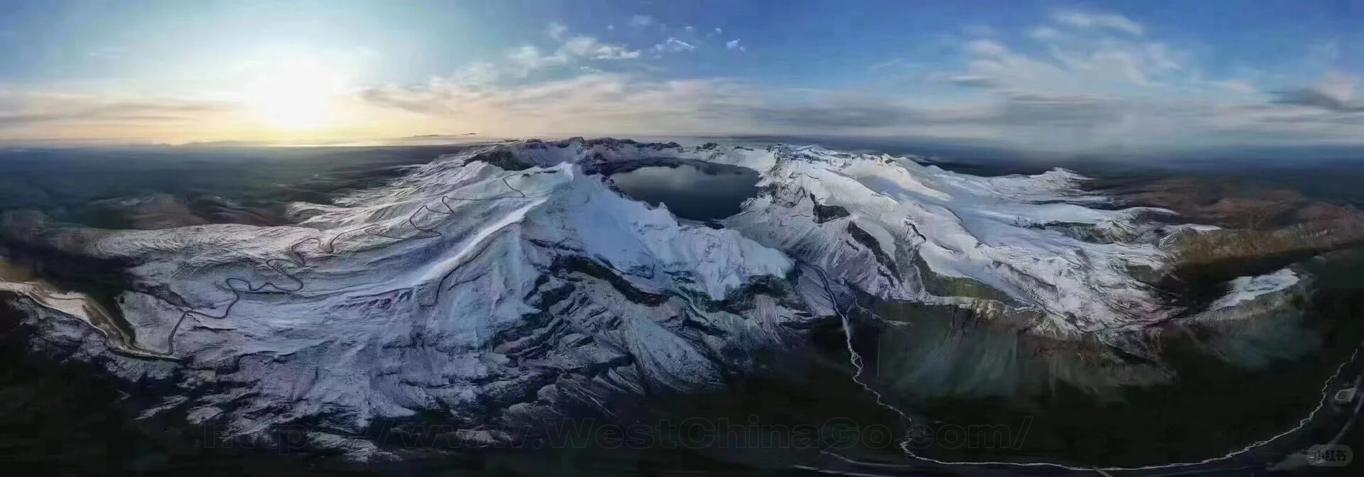
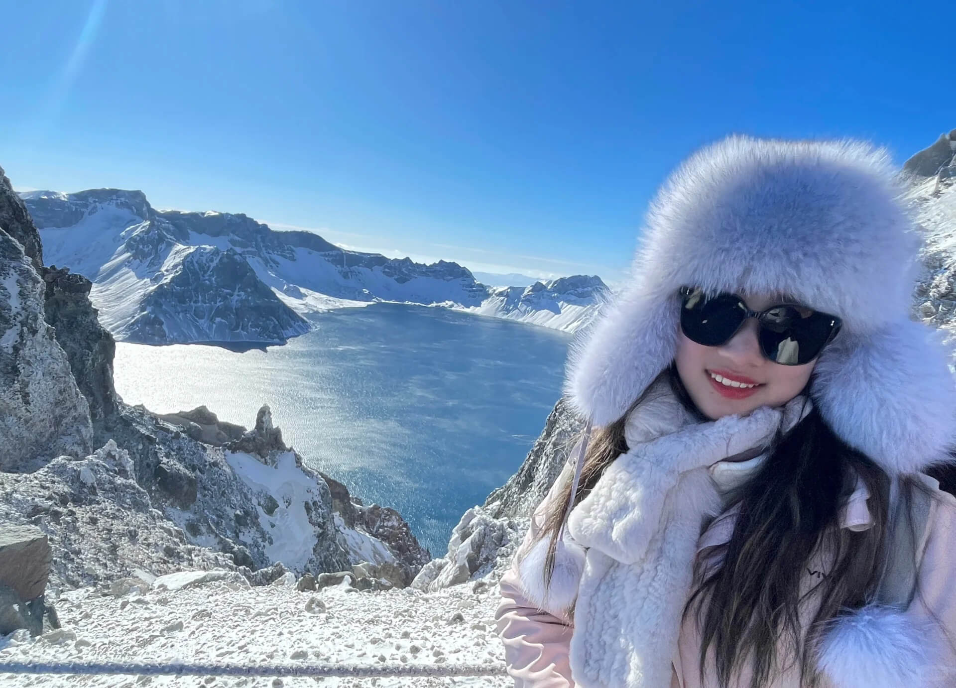
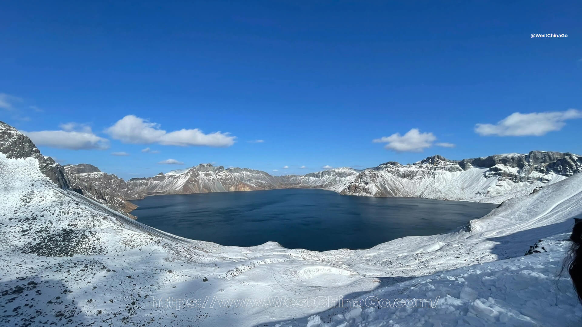
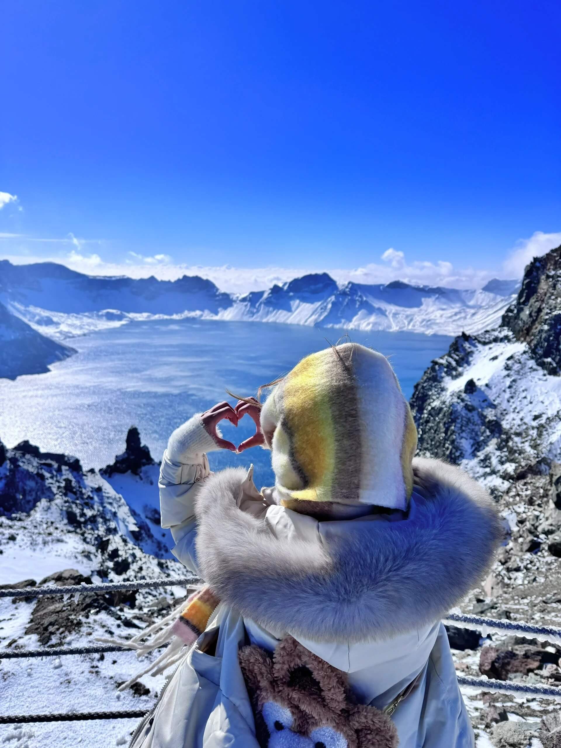
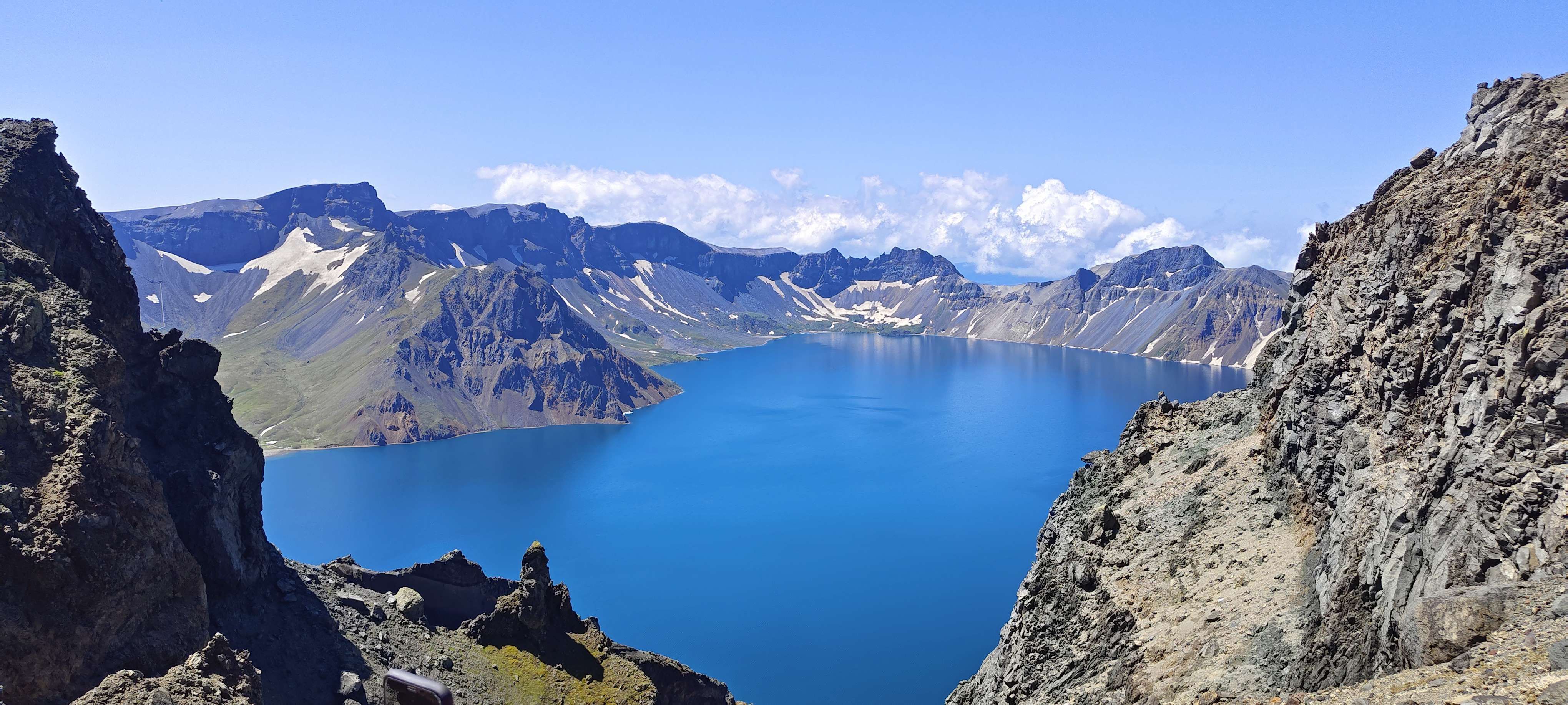
The Spectacular Heaven Lake
At the heart of Changbai Mountain lies Heaven Lake, a volcanic crater lake that is a must-visit during the winter season. The lake freezes over, creating a stunning mirror-like surface that reflects the surrounding snow-capped peaks. The ethereal beauty of Heaven Lake, combined with the tranquil ambiance of the mountain, provides a perfect backdrop for photography and quiet contemplation.
Hot Springs and Winter Wellness
One of the unique features of Changbai Mountain is its natural hot springs, which offer a warm retreat amidst the cold winter air. Visitors can soak in the mineral-rich waters while enjoying the scenic snowy landscapes, making it a perfect spot for relaxation and rejuvenation. The hot springs are believed to have therapeutic properties, providing a wellness experience that enhances the overall visit.
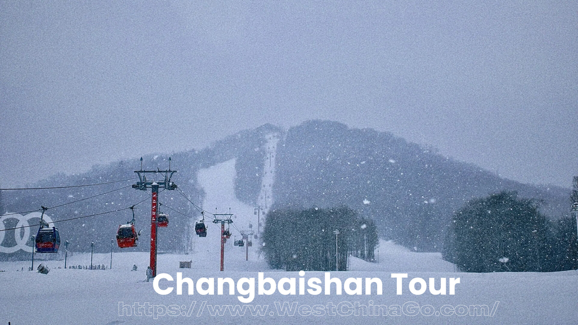
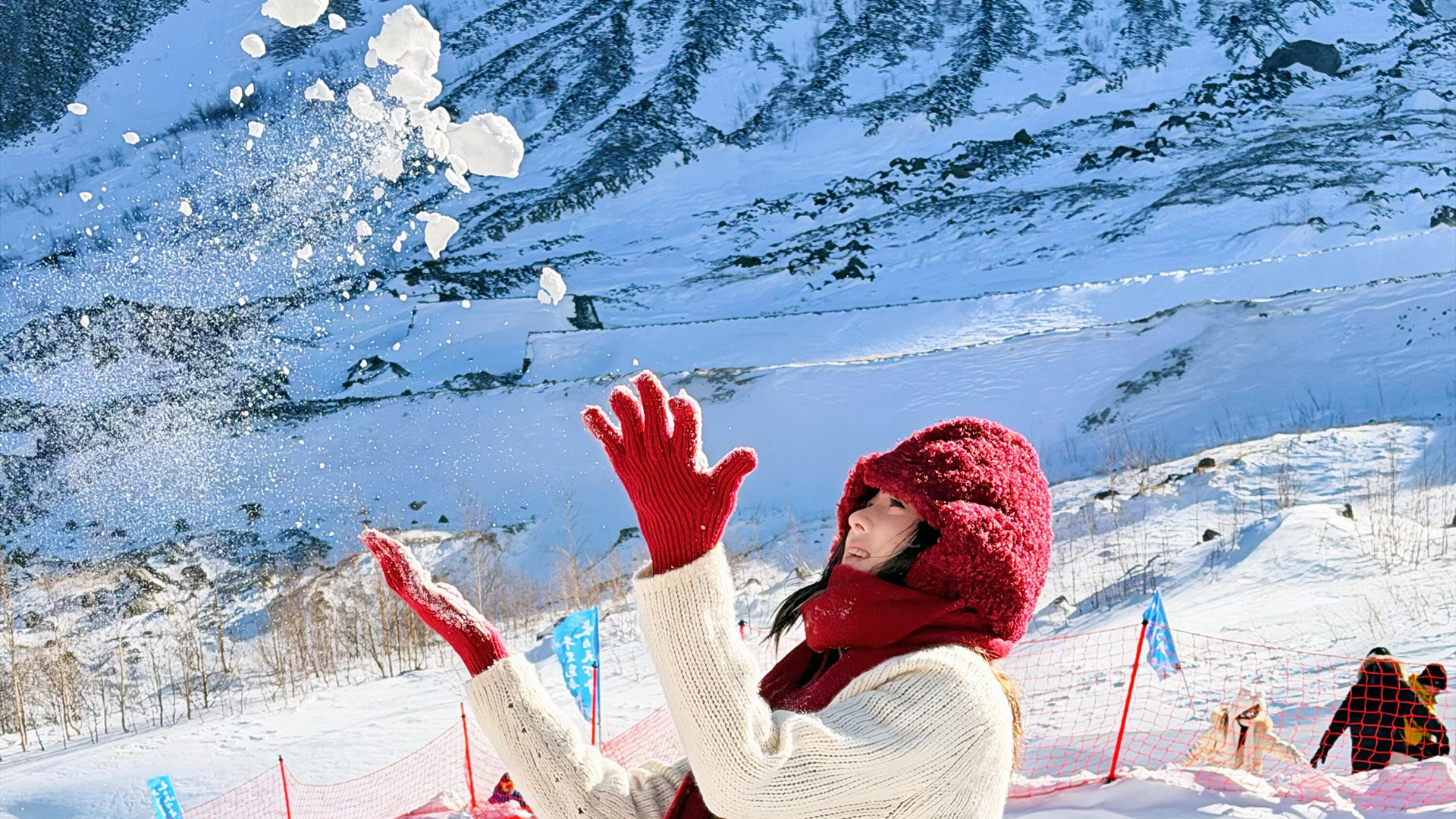
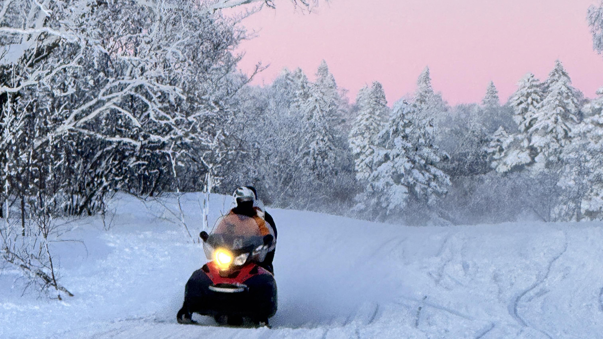
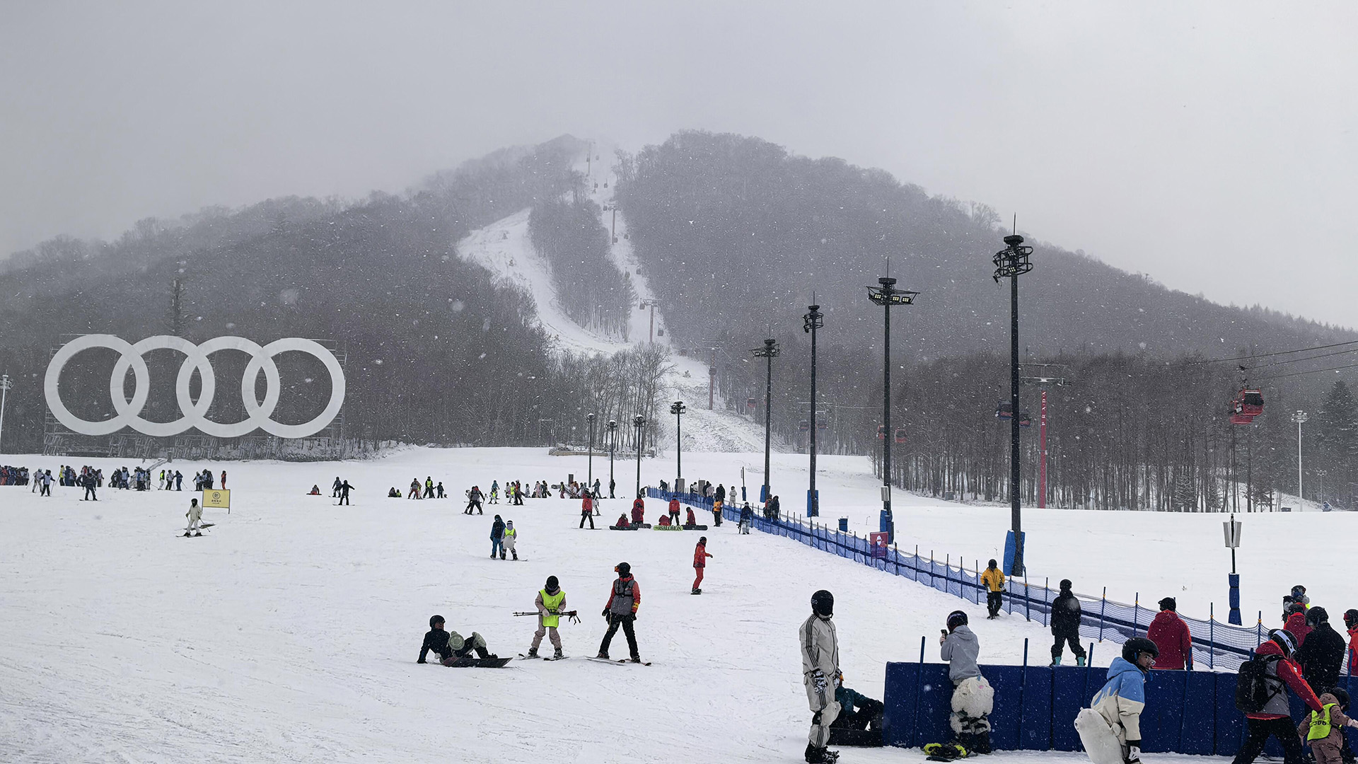
Winter Sports and Adventure
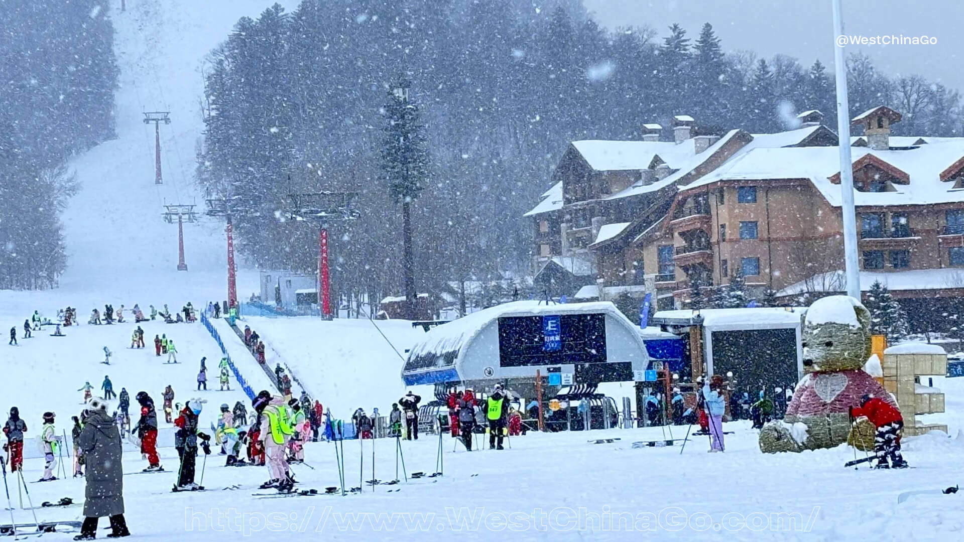
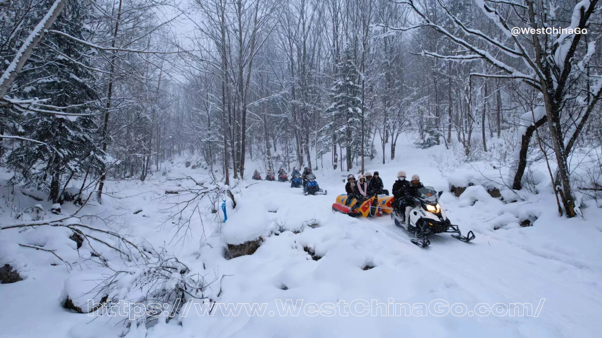
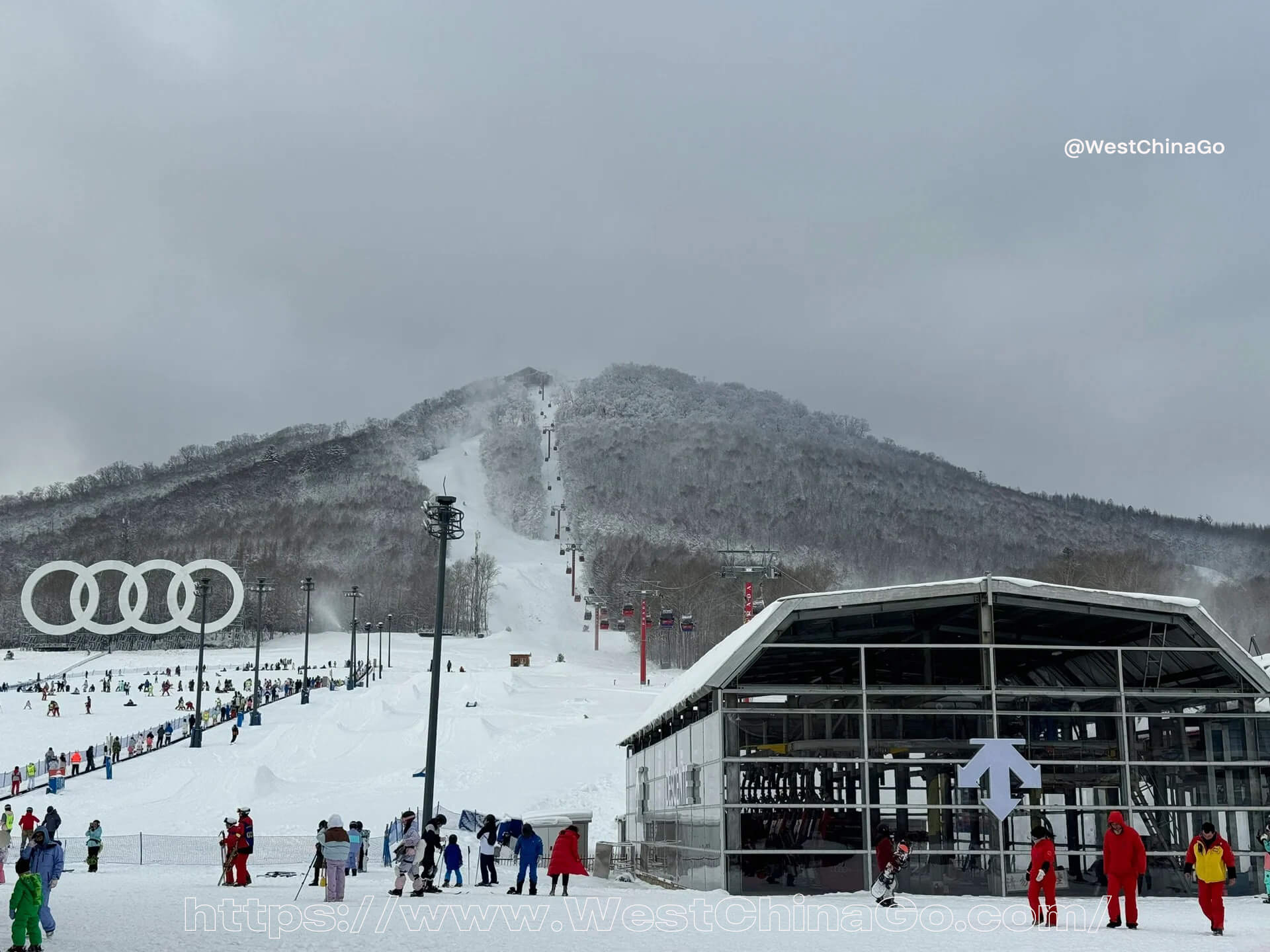
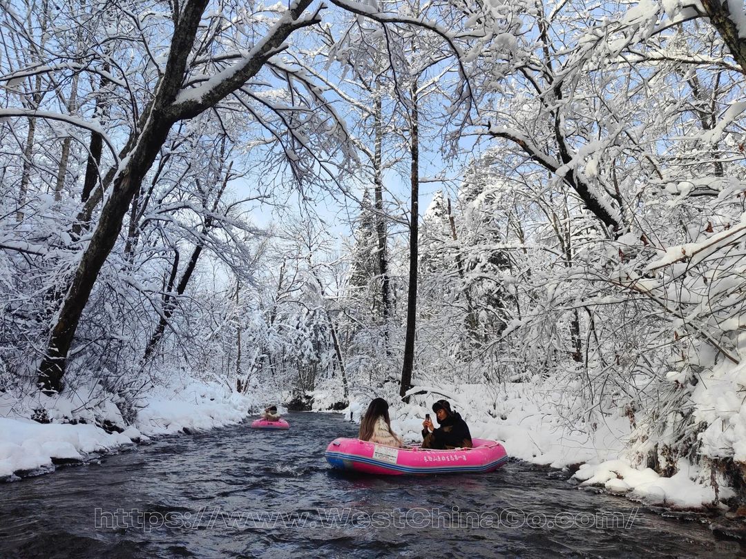
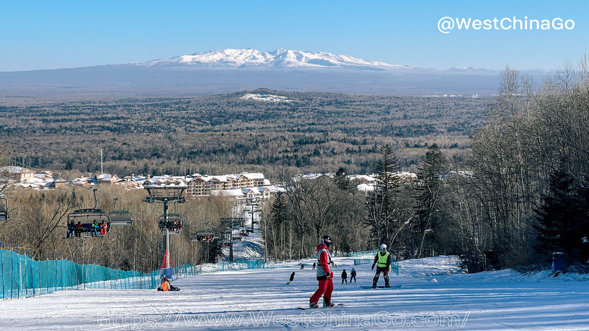
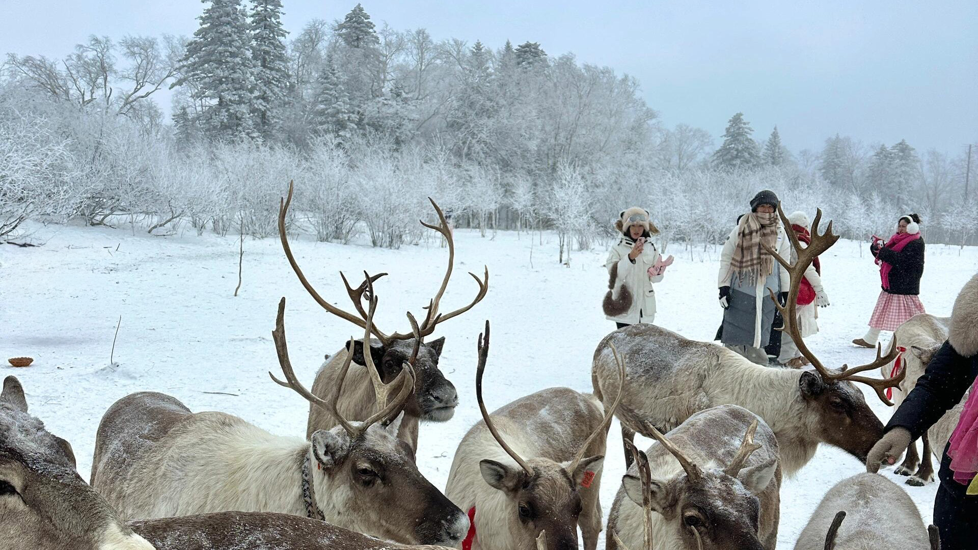
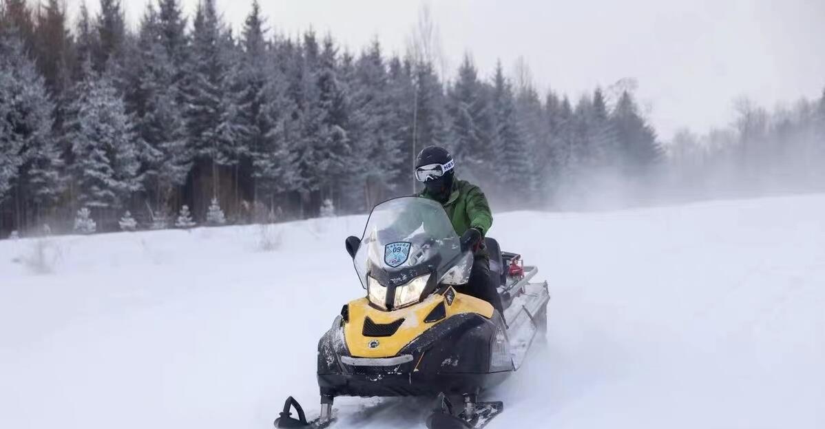
Changbai Mountain is a haven for winter sports enthusiasts. The region offers various activities such as skiing, snowboarding, and snowshoeing, catering to both beginners and experienced adventurers. The well-maintained slopes and facilities ensure a safe and enjoyable experience for all. For those seeking a more tranquil adventure, guided snow hikes provide an opportunity to explore the mountain’s hidden trails and discover its winter wonders.
Why Visit Changbai Mountain in Winter?
Changbai Mountain in winter is a destination that promises both adventure and tranquility. Its stunning natural landscapes, unique geothermal features, and opportunities for winter sports make it an ideal getaway for travelers seeking a blend of excitement and relaxation. Whether you’re an outdoor enthusiast, a wellness seeker, or someone looking to experience the charm of a winter wonderland, Changbai Mountain offers a memorable journey.
Plan your winter escape to Changbai Mountain and immerse yourself in the enchanting beauty of this extraordinary destination. Let the serene environment, thrilling activities, and soothing hot springs provide an unforgettable winter adventure.


Changbai Mountain Tourist Map
Changbaishan Tours Video
Changbai Mountain Tour Transfer: Car Rental with Driver


Changbai Mountain Travel Guide
Tour order
The three scenic spots have different landscapes, and the tour order is: North Scenic Area-West Scenic Area-South Scenic Area.
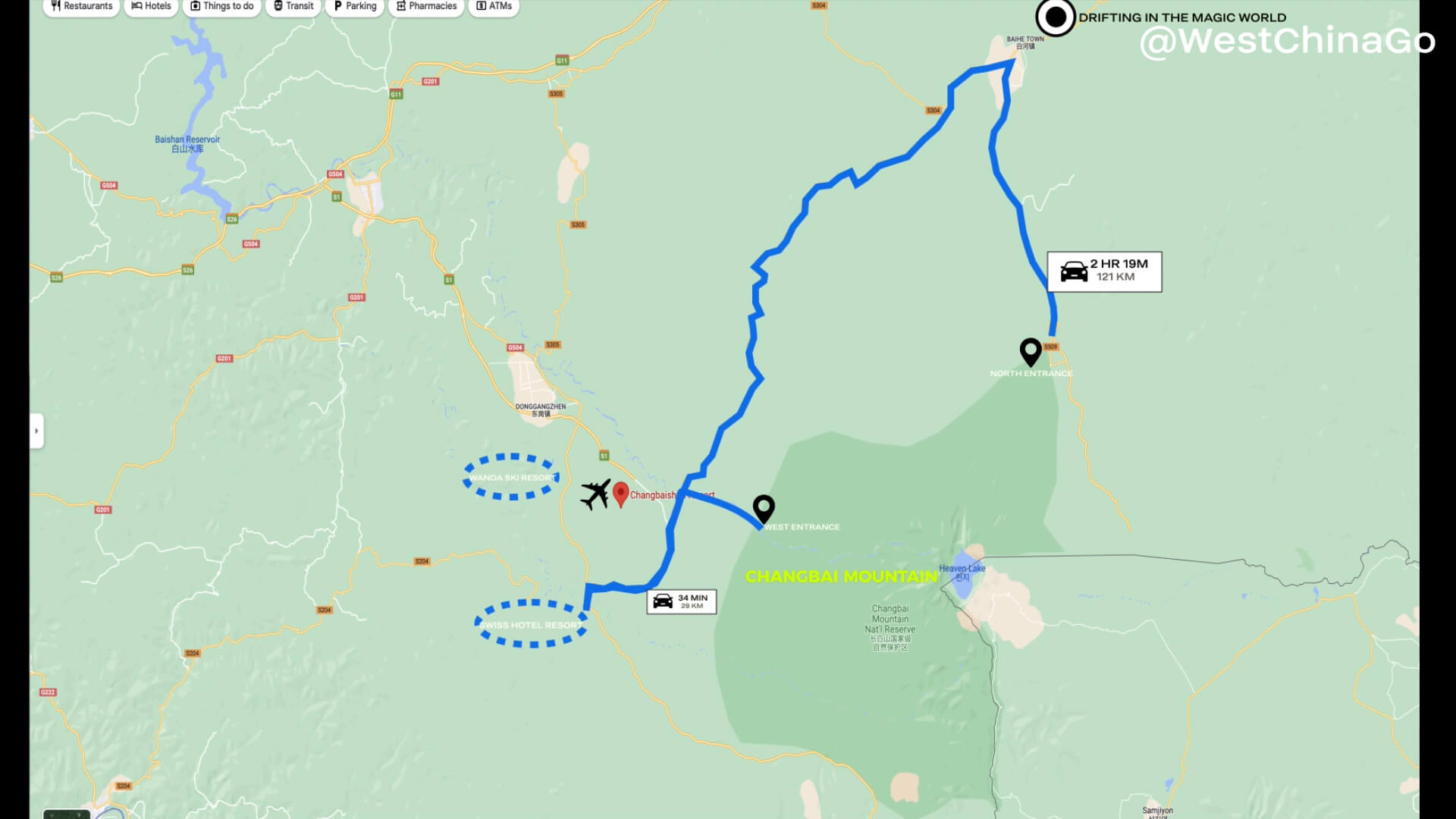
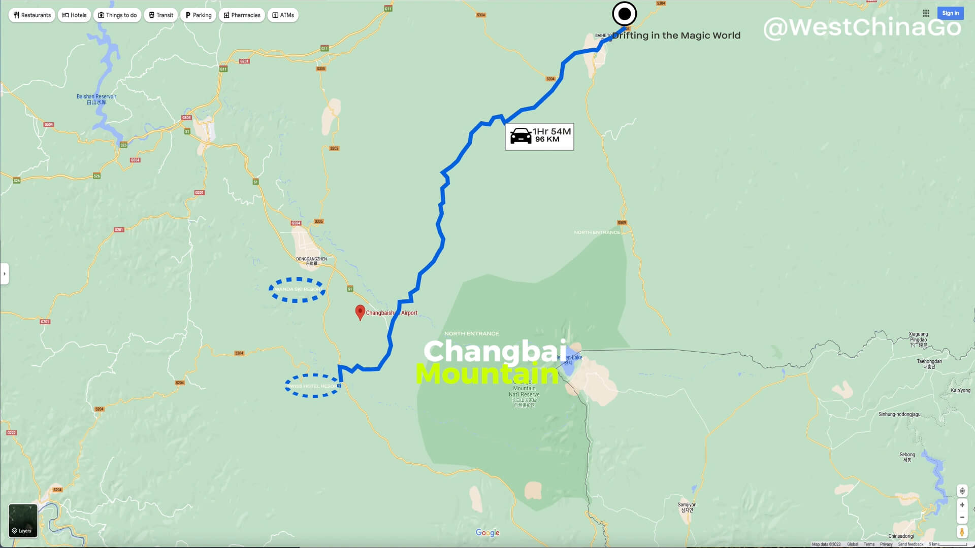
The North Scenic Area
The North Scenic Area is usually a must-visit scenic spot, because the North Scenic Area has rich landscapes and many scenic spots, which can represent the characteristics of Changbai Mountain. In the North Scenic Area there are the spectacular Changbai Waterfall, the mysterious and pristine forest at the bottom of the valley, the hot Julong Hot Spring in winter, and small scenic spots such as Xiaotianchi and Lvyuantan. There are small stalls selling hot spring eggs with unique taste in the hot spring square on the mountain, you can try them.
The West Scenic Area
After visiting the North Scenic Area, you can spend another day going to the West Scenic Area for an in-depth tour. The West Scenic Area is relatively close to Changbaishan Airport. The main landscapes include Jinjiang Grand Canyon, Alpine Garden, Wangchi, and the China-Korea Boundary Monument. Every July and August is the flowering period of Iris Garden, Alpine Garden, and Wangchi Garden. At that time, wild flowers can be seen all over the mountain, which is very spectacular. To see Tianchi in the West Scenic Area, you need to climb 1440 steps first, which is a small test for physical strength.
The South Scenic Area
The South Scenic Area is located at the southern foot of Changbai Mountain. It was developed late, with fewer tourists and more primitive natural landscape. There are Yalu River Grand Canyon, volcanic relics carbonized wood landscape, and you can also overlook the North Korean scenery on the other side of the Yalu River along the way up the mountain, while the view from the top of the south slope is wide, and you can see the Tianchi Lake at a glance.
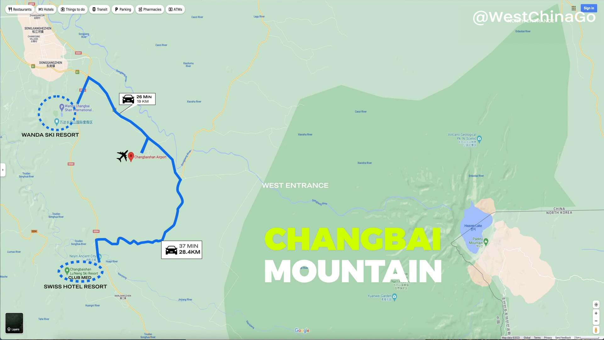
Tourist distribution bases
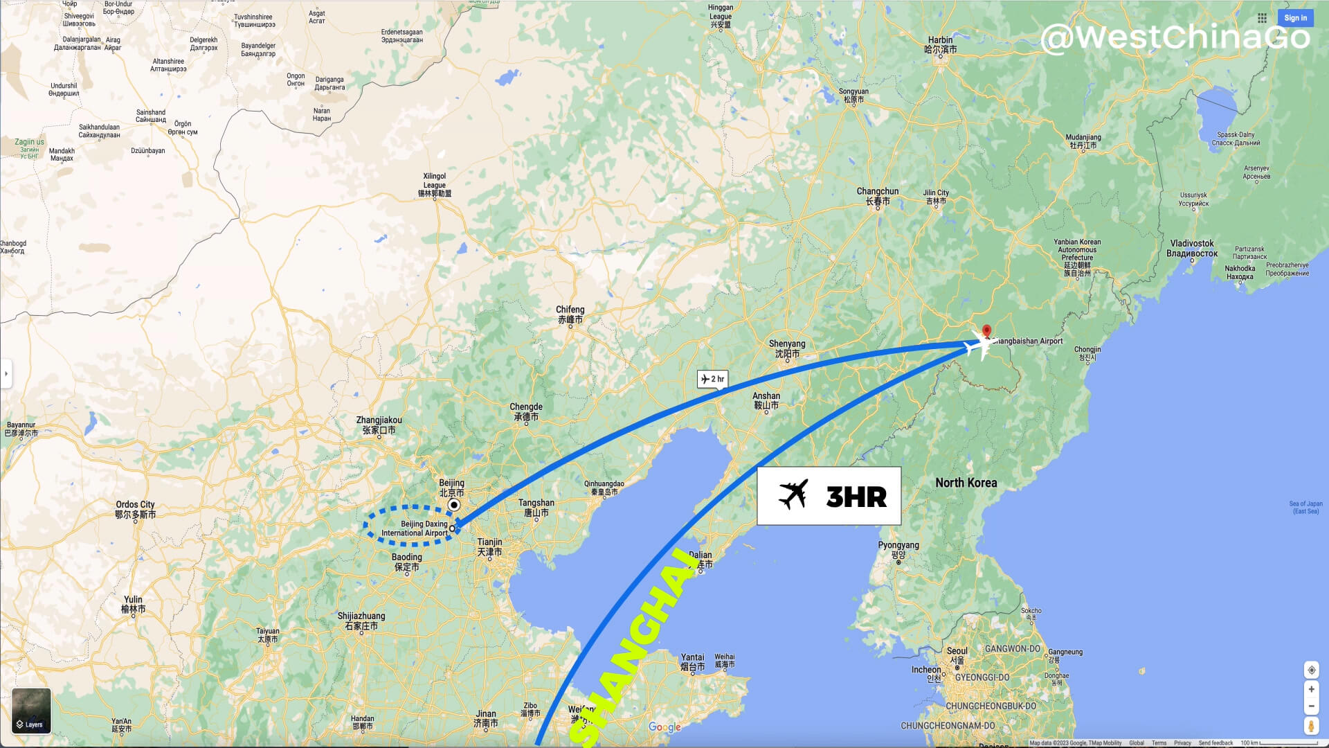
When you come to Changbai Mountain Scenic Area, you usually choose Erdaobaihe Town and Songjianghe Town as the tourist distribution bases. The distance between the two towns is more than two hours. The Wanda Tourist Resort in the southern suburb of Songjianghe Town gathers many brand hotels such as Westin and Hyatt, and also has a high-level ski resort, which is suitable for winter vacations.