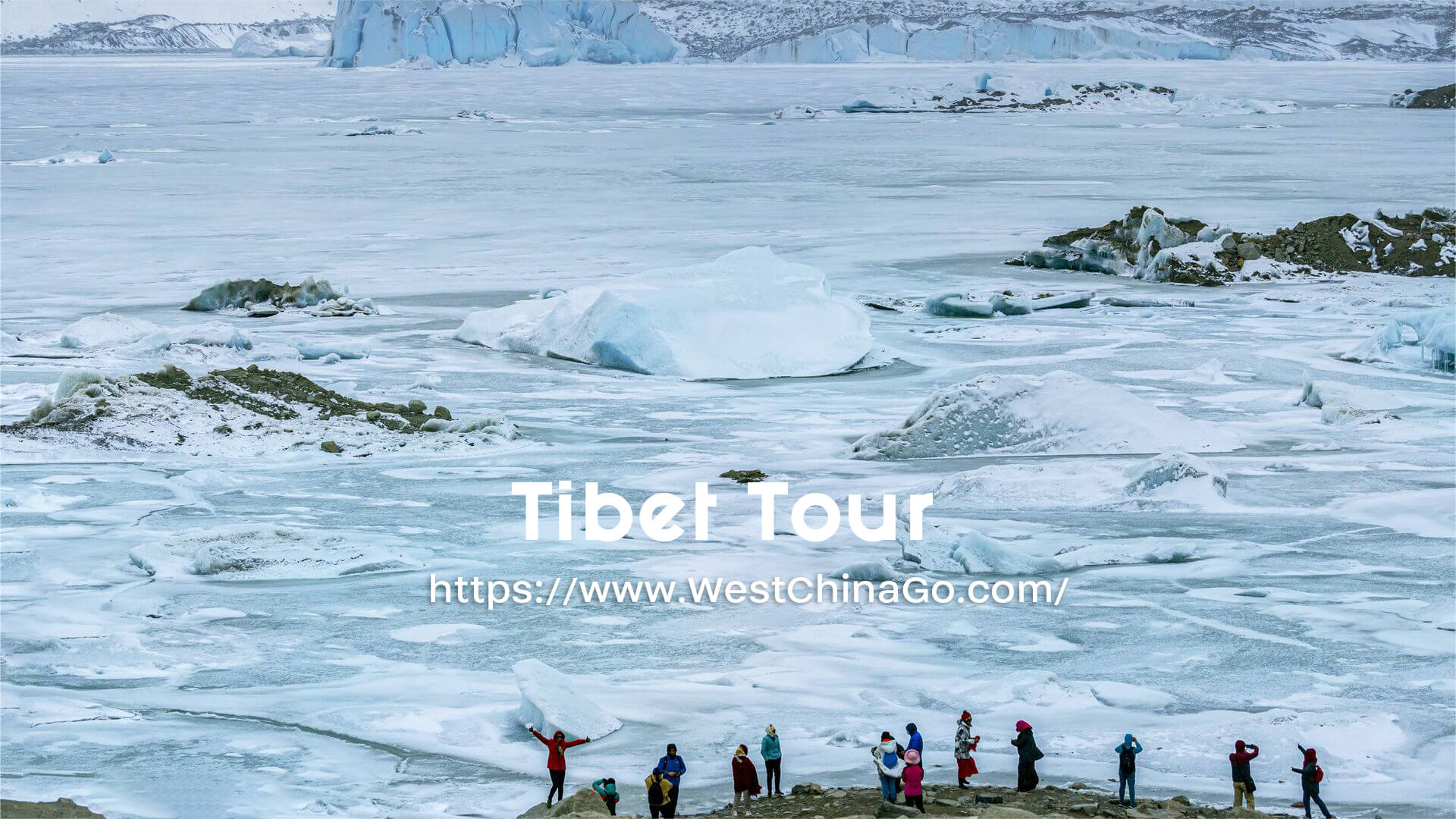
Kailash Tibet
- Chinese Name:冈仁波齐
- Add: Pulan County, Ali Region,Tibet 阿里地区普兰县
- Opening Time: 09:00-21:00
- Tickets: 150 CNY/per
Kailash Tibet
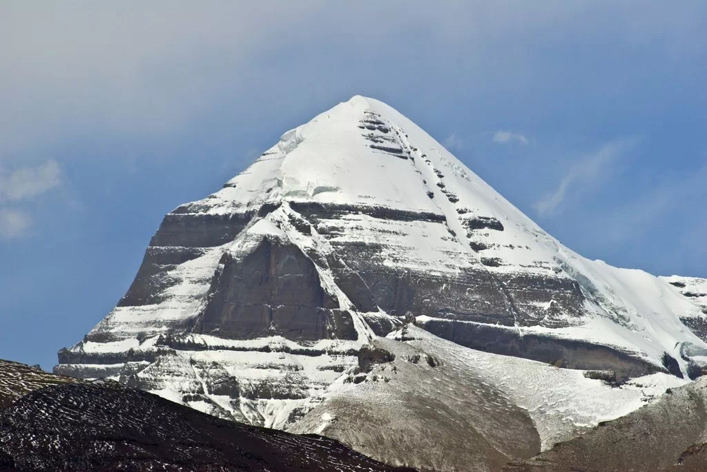
Mount Kailash: The Sacred Summit of Tibet
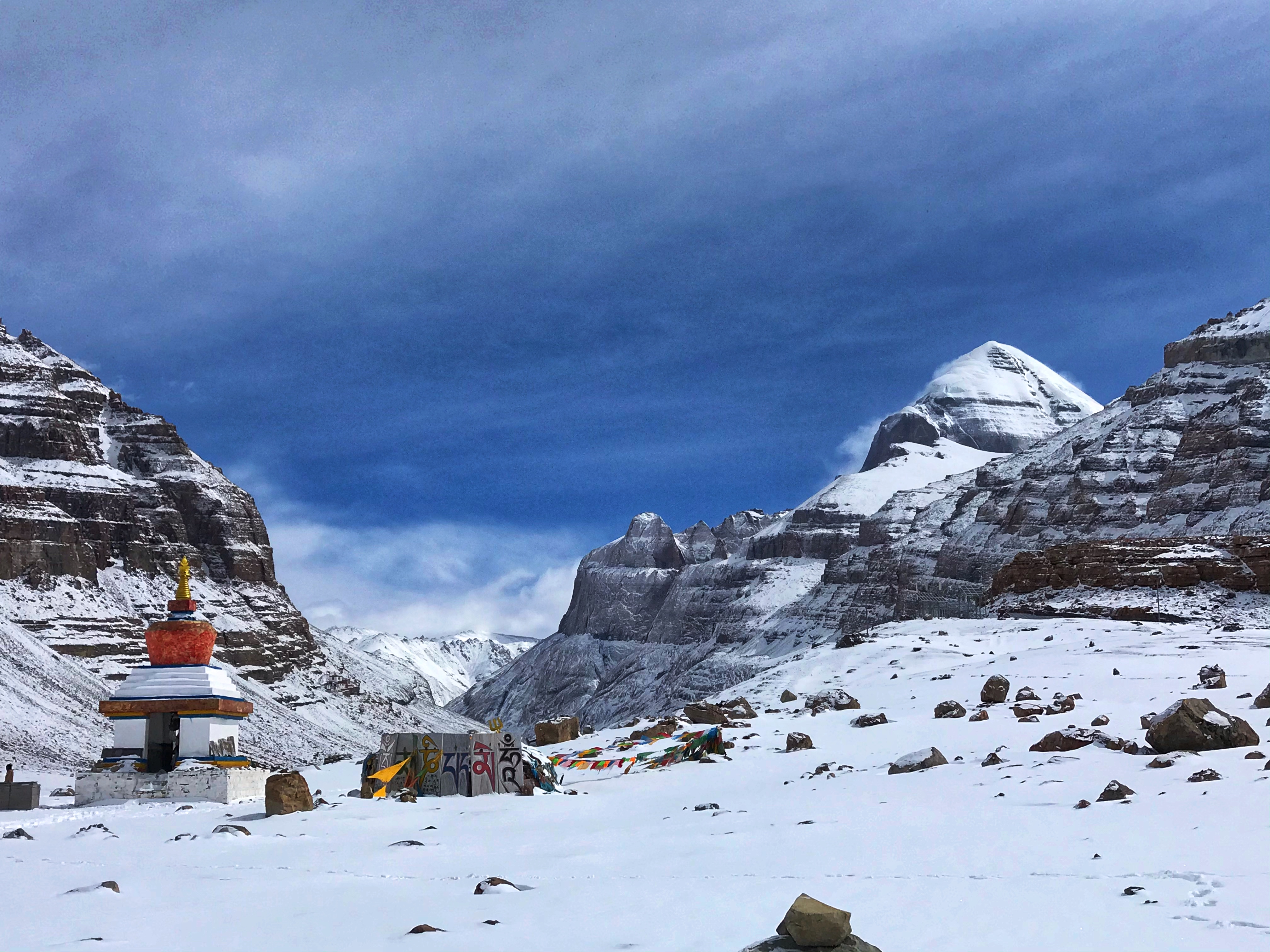
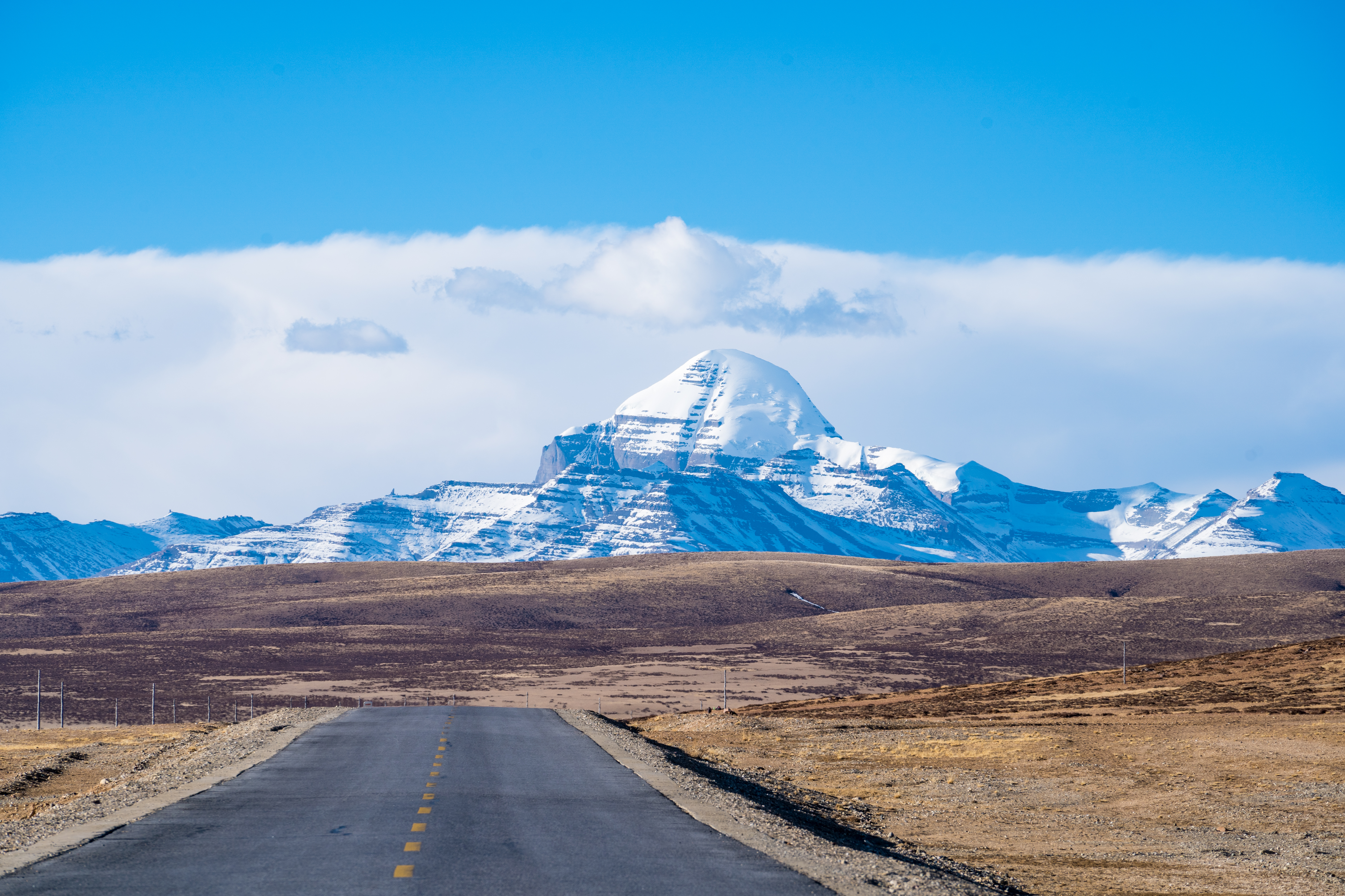
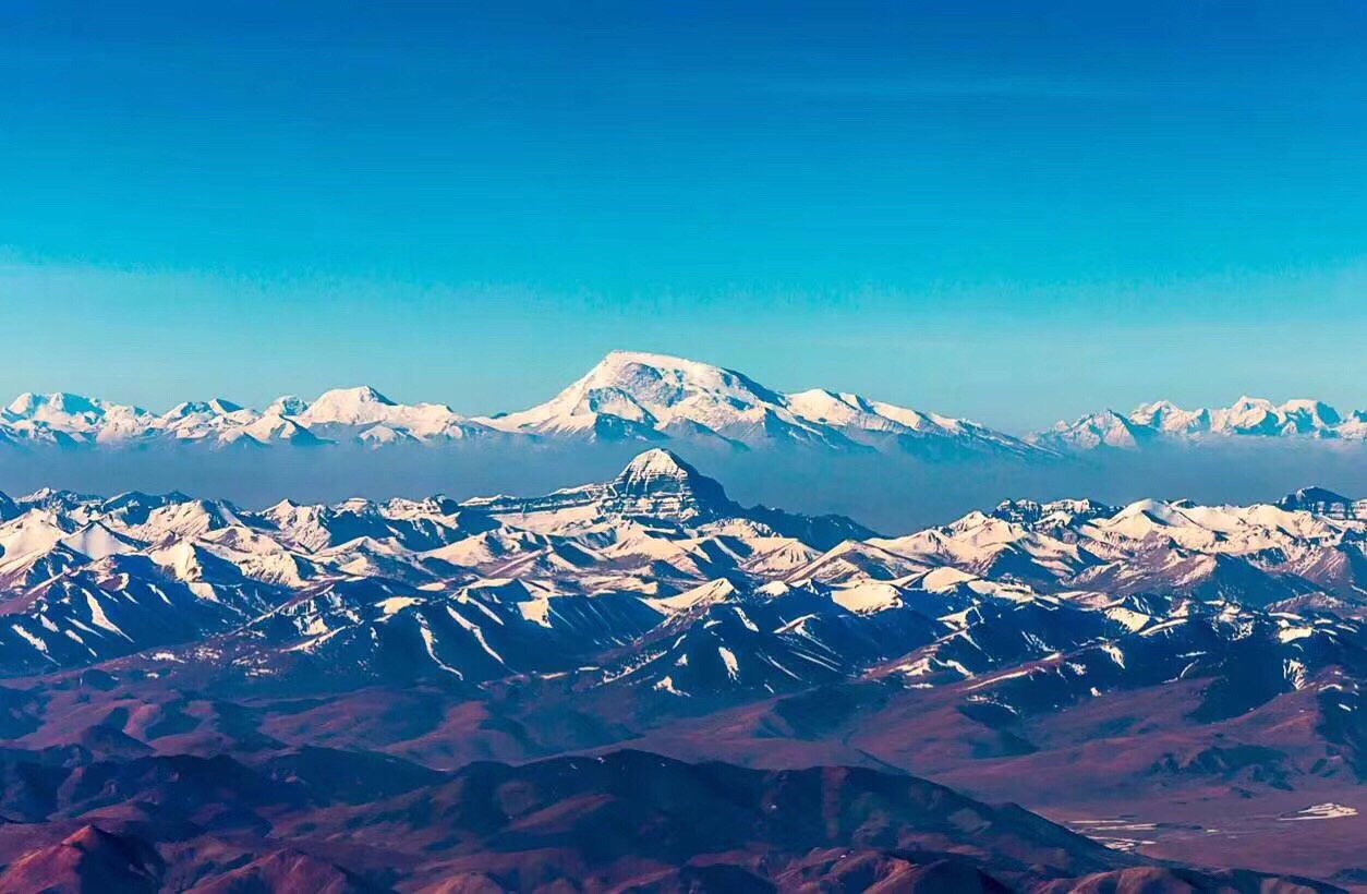
Rising majestically to an altitude of 6,638 meters (21,778 feet), Mount Kailash is not just a peak; it is a profound spiritual symbol and a destination of unparalleled beauty. Revered as the most sacred mountain in the world, it draws pilgrims and adventurers alike, offering an experience that transcends the ordinary.
A Spiritual Epicenter
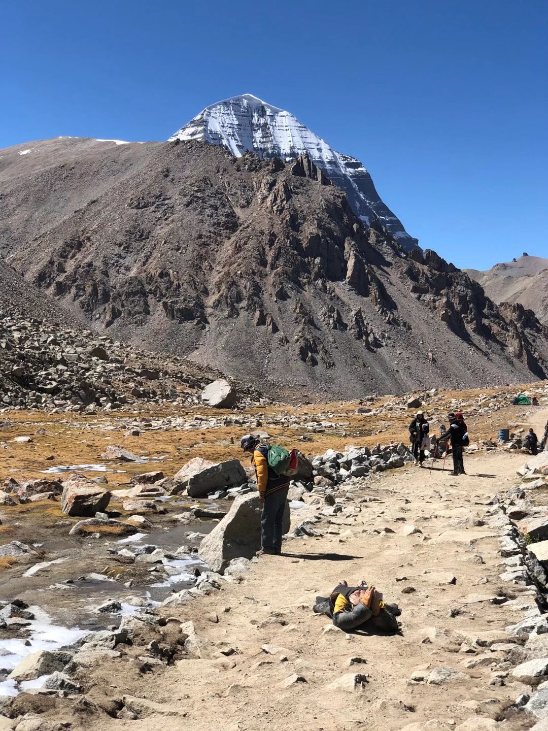
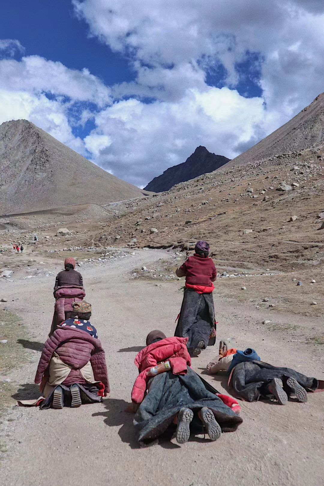
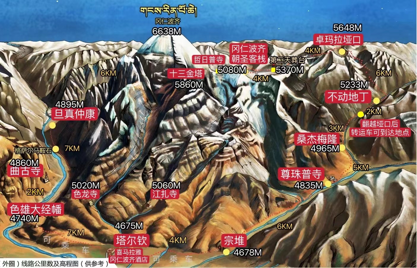
Mount Kailash is considered sacred in four major religions—Hinduism, Buddhism, Jainism, and Bon. It is believed to be the abode of Lord Shiva in Hindu mythology, a representation of Mount Meru in Buddhism, and the site of enlightenment in Jain and Bon traditions. The mountain’s spiritual significance makes it a global pilgrimage site, where devotees undertake the Kora—a 52-kilometer (32-mile) circumambulation around the peak, believed to cleanse sins and bring spiritual merit.
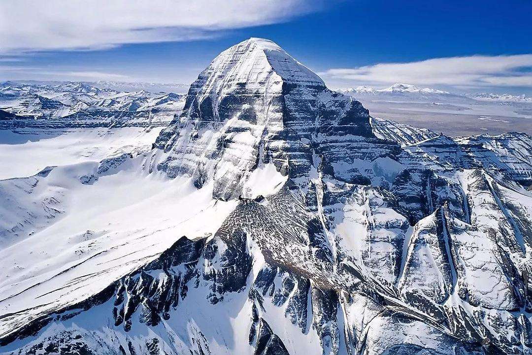
An Untouched Natural Wonder
Despite its fame, Mount Kailash remains unclimbed, preserving its sanctity and mystery. Surrounded by breathtaking landscapes of the Tibetan Plateau, including the turquoise waters of Lake Manasarovar and the stark beauty of Lake Rakshastal, the area offers a serene escape into nature’s grandeur.
A Challenge for the Adventurous
For trekkers and adventure enthusiasts, the Mount Kailash Kora is a once-in-a-lifetime challenge. Traversing high-altitude passes, including the formidable Dolma La Pass at 5,630 meters (18,471 feet), the journey tests physical endurance while rewarding participants with awe-inspiring views and a sense of profound accomplishment.
Cultural Immersion
A visit to Mount Kailash also offers an opportunity to engage with the vibrant local culture. The nearby town of Darchen serves as the starting point for treks and provides a glimpse into Tibetan nomadic life. Festivals such as the Saga Dawa Festival, celebrating the birth, enlightenment, and death of Buddha, add a colorful and spiritual dimension to the experience.
Why Visit Mount Kailash?
Mount Kailash is more than a destination—it’s a journey of the soul. Whether you’re seeking spiritual fulfillment, natural splendor, or an epic adventure, this sacred mountain promises a transformative experience. Embark on a journey to Mount Kailash and discover the heart of Tibet’s mystique.
Tibet Kailash Tourist Map

Kailash Tibet Travel Guide
must see travel tips (Practical strategy)
- The journey outside the mountain is 56 kilometers long, and the altitude is relatively high, and those with average physical fitness and strength should be cautious.
- For a two-day itinerary, you need to stay in the mountains for one night. The conditions of the accommodation are poor, it is recommended to bring your own down sleeping bag, or choose an accommodation with electric blankets and oxygen supply.
- Those who have poor physical strength can ask porters to help carry their luggage in Taqin. Generally, the minimum rent is 3 days, about 330 yuan per day.
- On the Zhuanshan Road, there are Tibetan tents and glass house accommodations along the way, providing food such as rice bowls, hot water, instant noodles in barrels, and buttered tea. Even so, it is recommended that trekkers carry some high-calorie foods and energy drinks with them.
- It is best to carry trekking poles, because it can save physical strength and ensure the safety of going up and down the mountain, and do a good job of basic protection from sun protection and warmth.
- For the first time to turn around the mountain, you must go with someone who is familiar with the road conditions, or you can download the track of Gang Rinpoche’s outer turn around the mountain in advance, and use it when you are offline to ensure the correct way. Don’t listen to the so-called online Fare evasion strategy, in places with such high altitudes, the temperature is erratic, and it is easy to lose vital signs if there is no immediate medical treatment due to hypothermia and hyperthermia.
- Mapang Yongcuo can drive around the lake. There are many gravel roads along the way, the whole journey is about 84 kilometers; Tibetan people mainly walk/kowtow. The lake is soft and easy to get stuck, so pay attention to precautions.
- The accommodations with good conditions along the lake in Manasarovar are mainly the accommodation provided by temples. If the budget is suitable, you can experience the starry sky camp in the tourist center of Manasarovar. The accommodation page is also a good option.