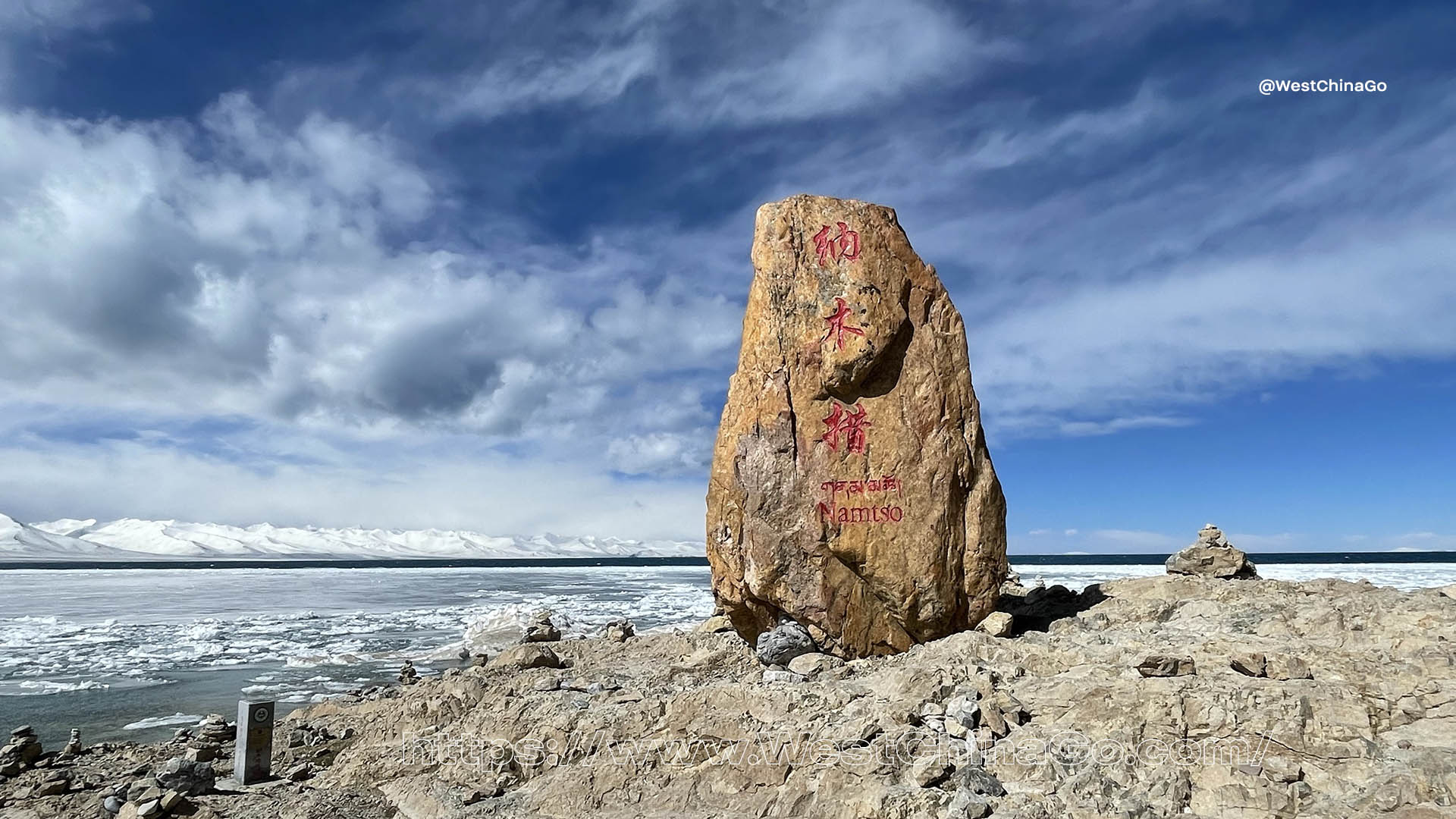
Namtso Lake
- Chinese Name: 纳木错
- Address: Damxung/Baingoin, Tibet, China
- Typesalt lake
- Coordinates: 30°42′N 90°33′E
- Max. length: 70 kilometers
- Max. width: 30 kilometers
- Average depth: 33 meters
- Surface area: 1,920 km2 (740 sq mi)
- temperature: subtropical monsoon climate
- Altitude: 4,718m
- Admission Fee:Peak Season, May to October: 120CNY
- Off Season, November to Next April 80CNY
- Maximum depth: 120 meters
- Lake area: 1961km² (757.15 square miles)
- Storage capacity: 93.2km³ (22.3 cubic miles)
- Islands in the lake: 5
- Lake type: saltwater lake
- Culture: the birthplace of ancient Xiangxiong civilization
- Opening hours: 06:00~18:00
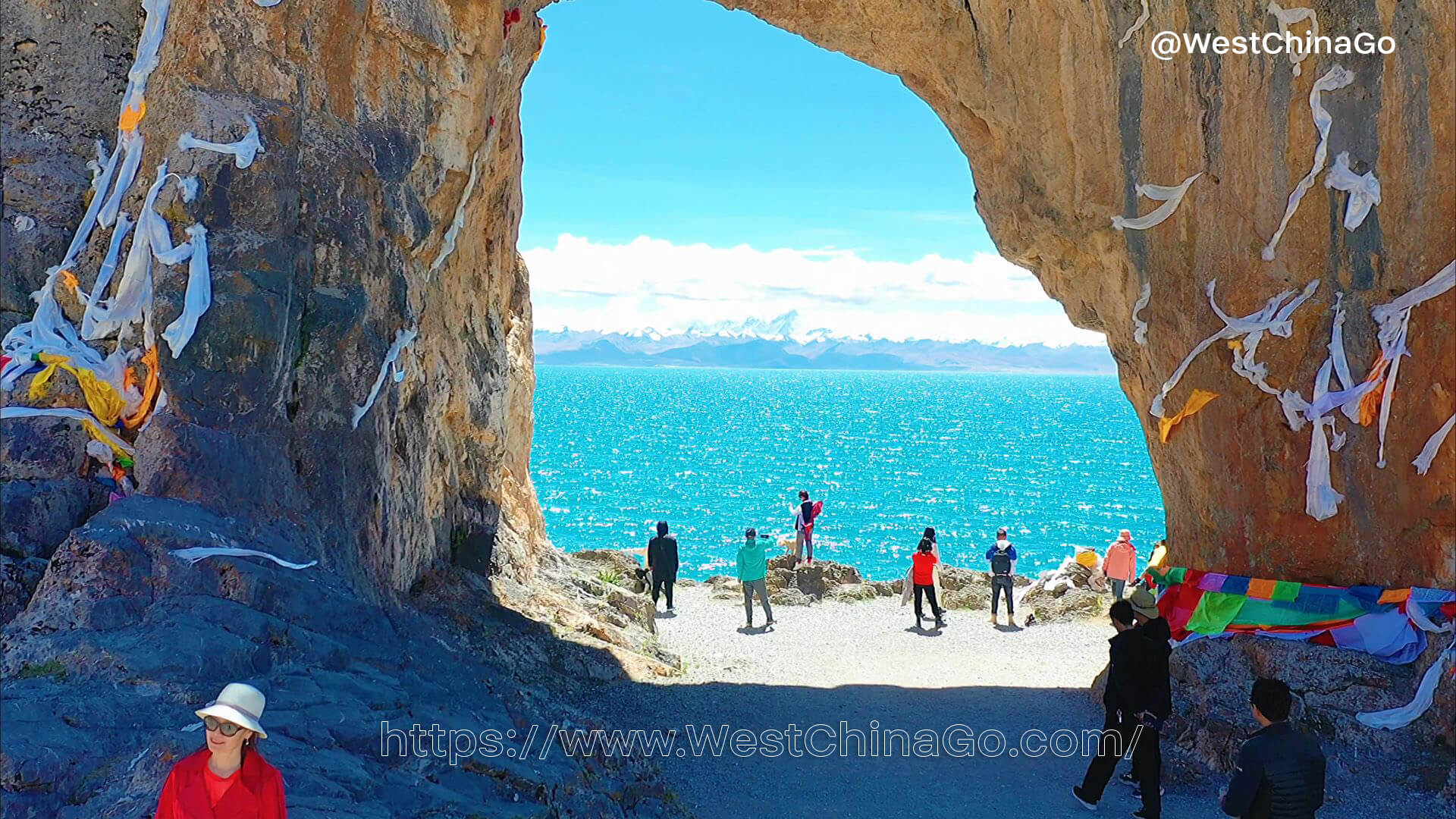
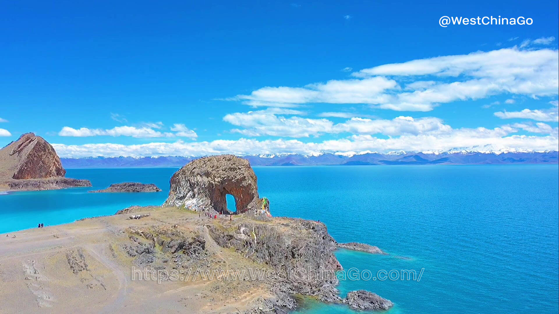
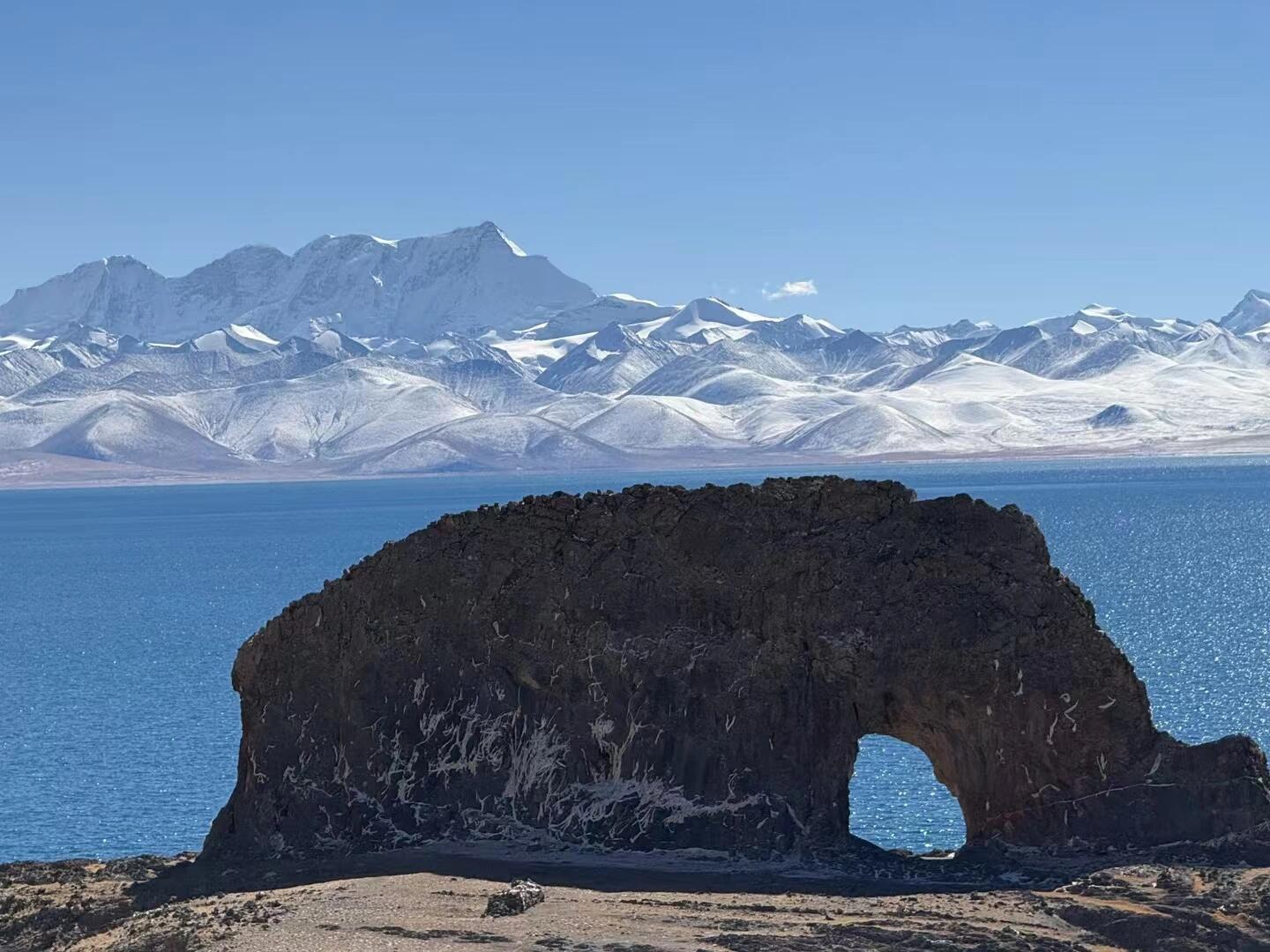
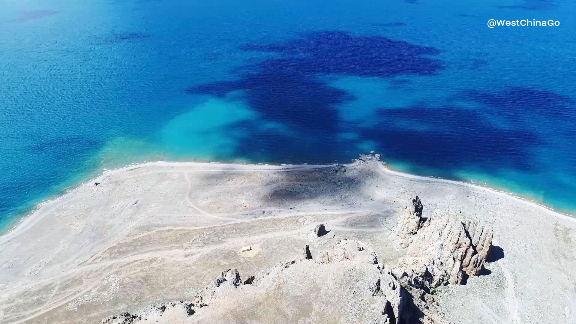
- Famous attractions: Nagenla, Tashi Peninsula, Gassho Stone
- Lake elevation: 4718 meters
Namtso Lake
Namtso Lake: The Heavenly Lake of Tibet
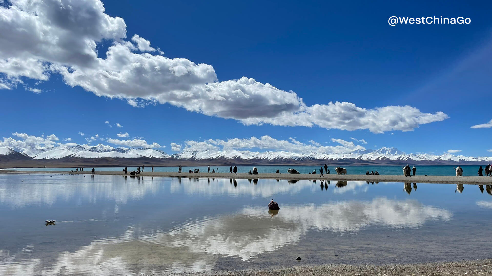
Situated at the heart of the Tibetan Plateau, Namtso Lake is a natural wonder that captivates travelers from around the globe. Known as the “Heavenly Lake” in Tibetan, this iconic destination offers a harmonious blend of breathtaking landscapes, spiritual significance, and unique cultural experiences.
A High-Altitude Marvel
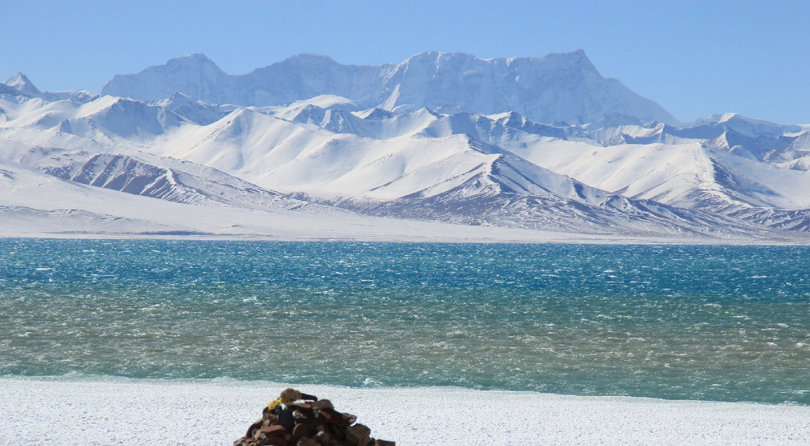
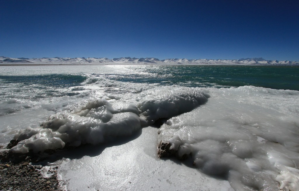
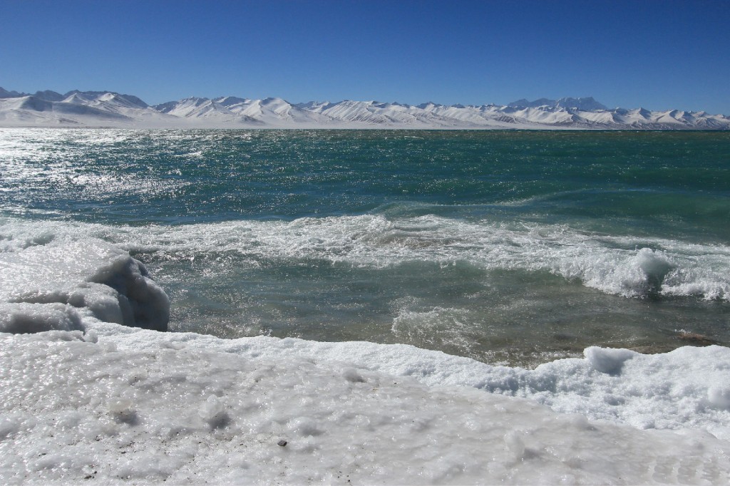
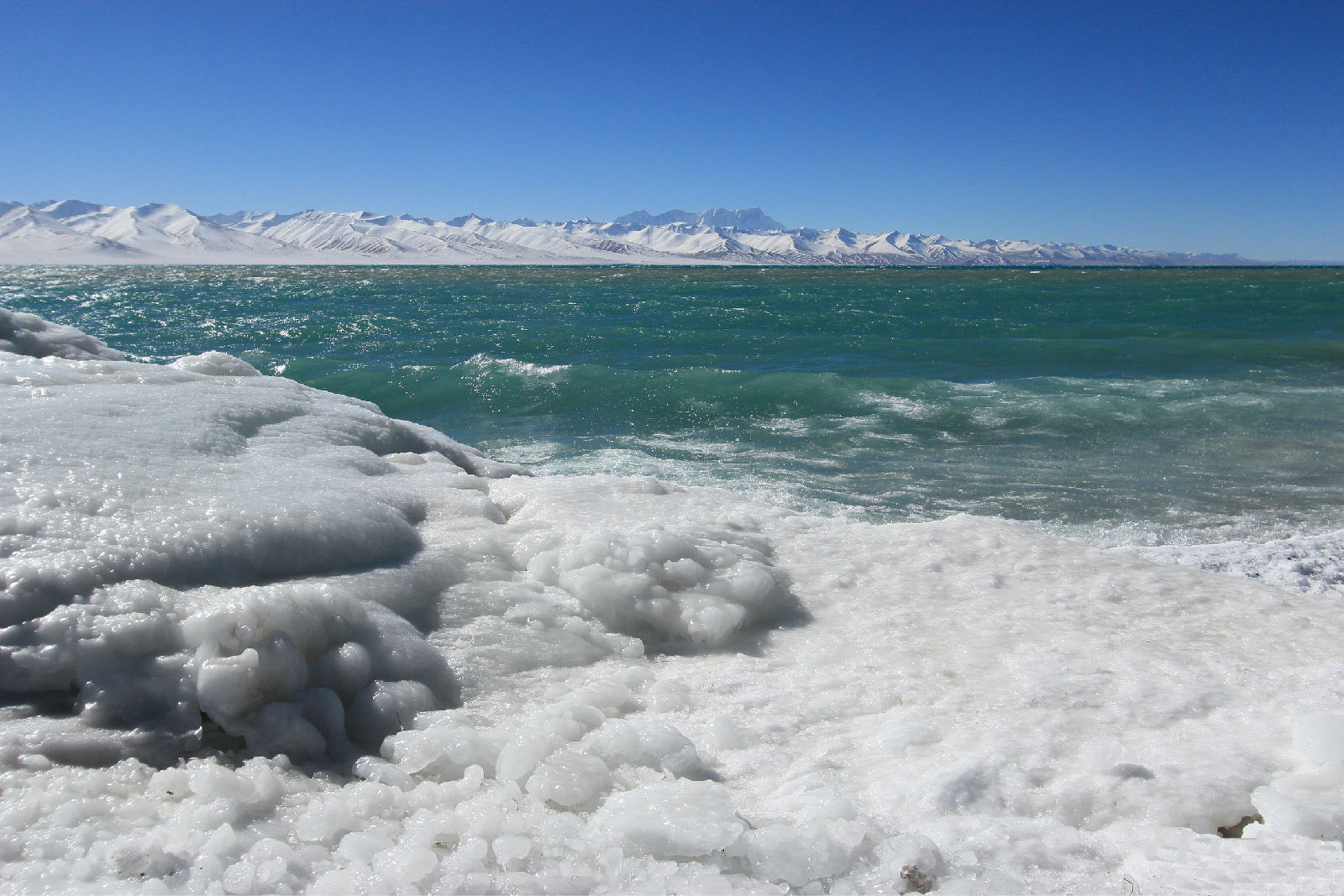
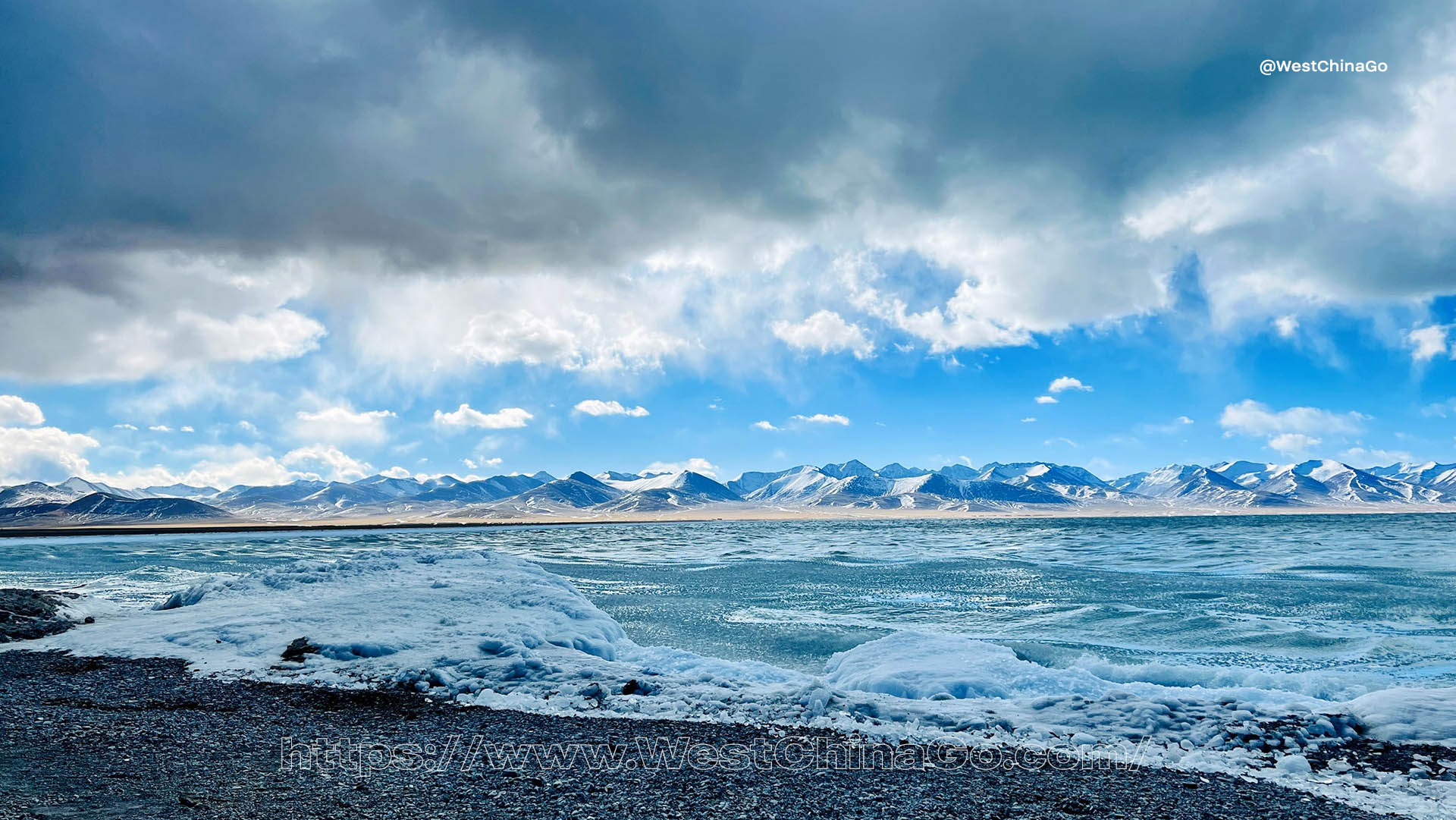
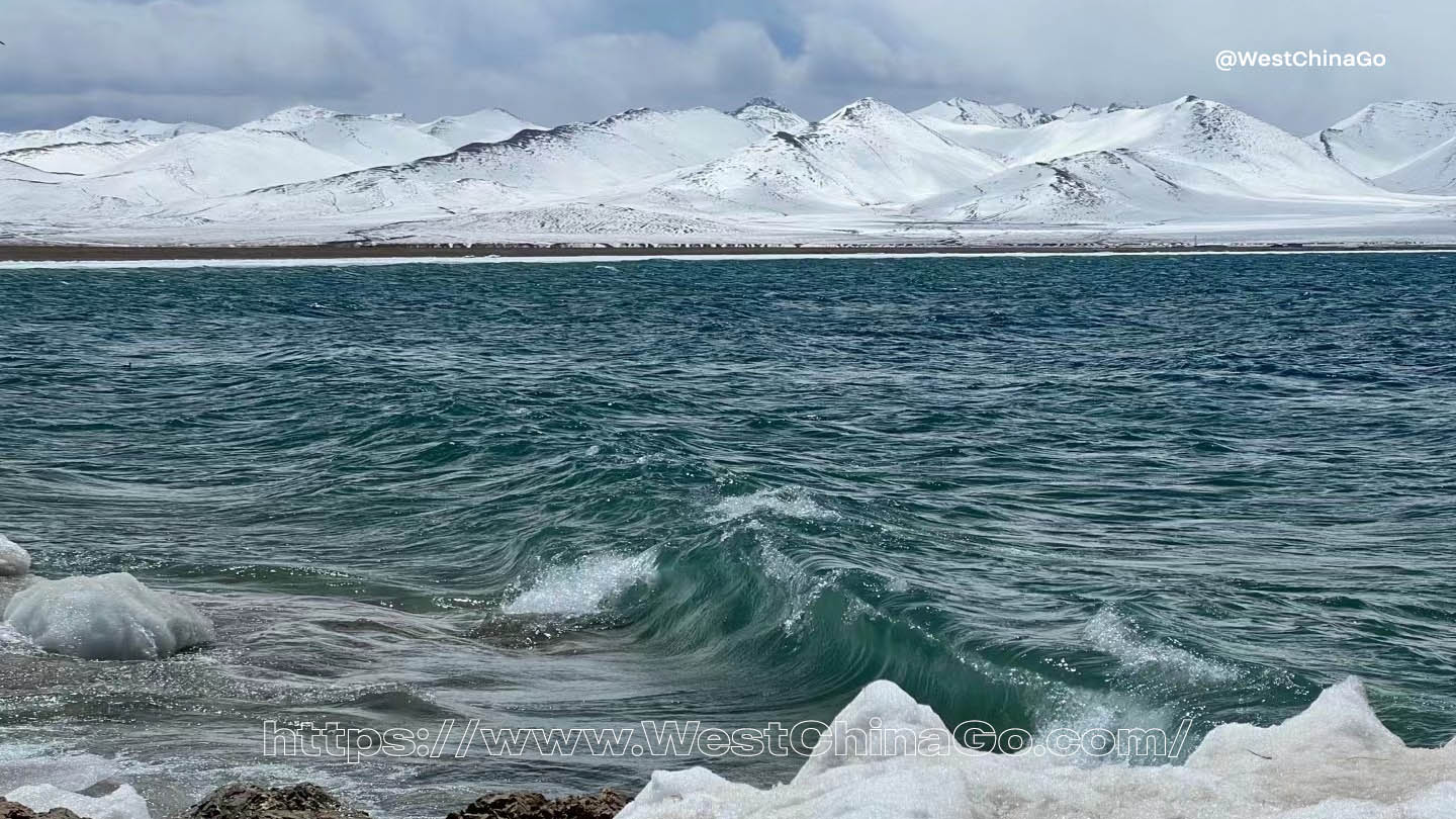
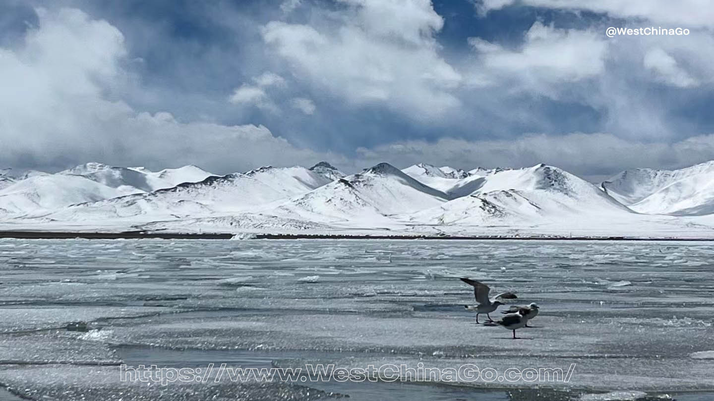
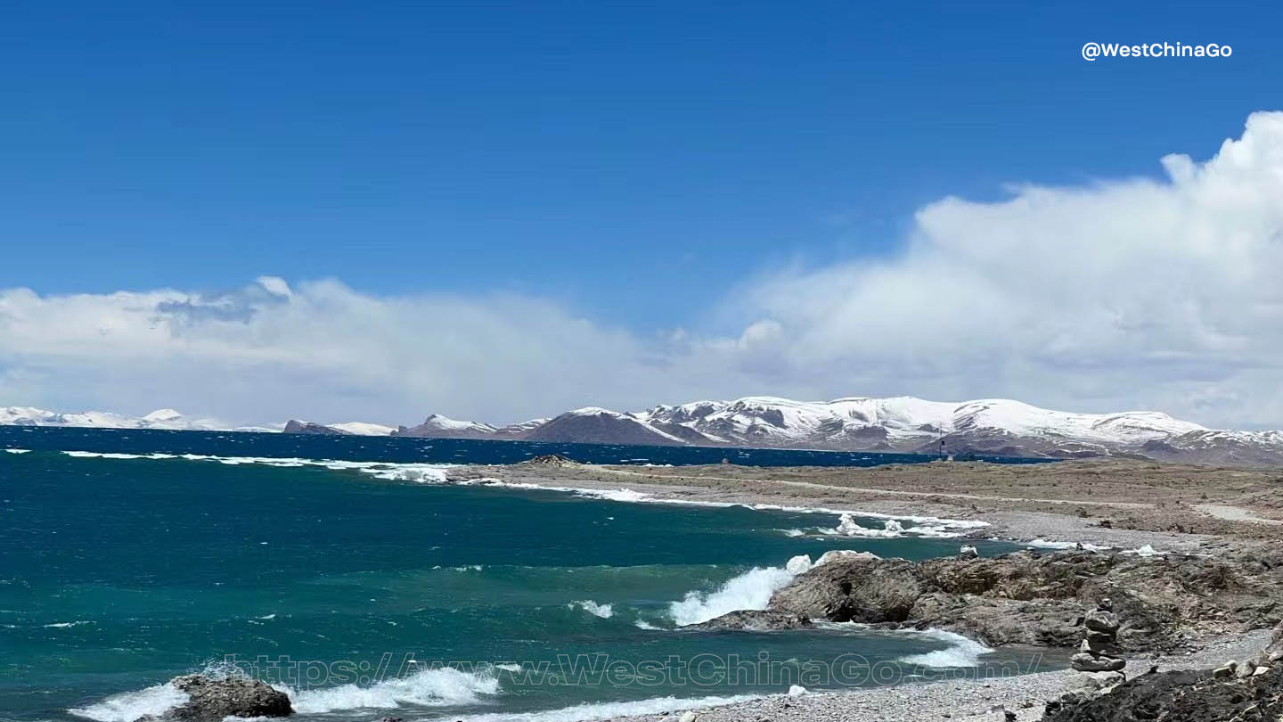
At an altitude of 4,718 meters (15,479 feet), Namtso Lake is one of the highest saltwater lakes in the world. Its crystal-clear waters stretch across 1,920 square kilometers, surrounded by snow-draped mountains and vast grasslands. On clear days, the lake mirrors the azure sky, creating an ethereal scene that feels like stepping into another world.
A Sacred Site for Pilgrims
Namtso is one of the holiest lakes in Tibetan Buddhism, drawing countless pilgrims who walk its circumference as a form of meditation and devotion. Believed to possess purifying and life-enhancing powers, the lake holds a revered place in local spiritual traditions. Visiting Namtso offers travelers the chance to witness or participate in these time-honored rituals, adding a profound cultural dimension to the experience.
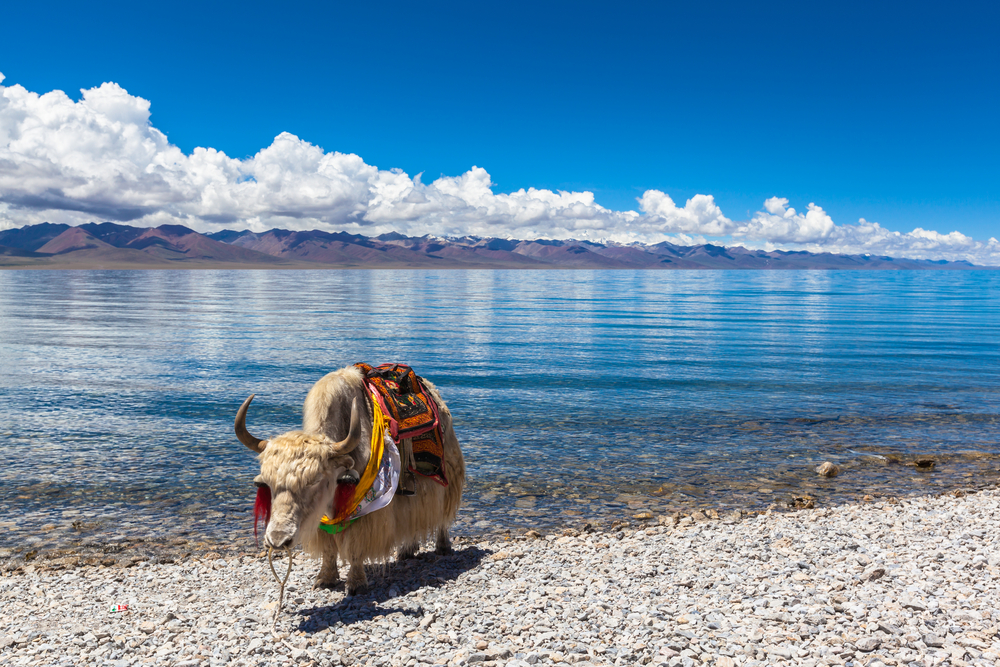
A Haven for Wildlife and Photography
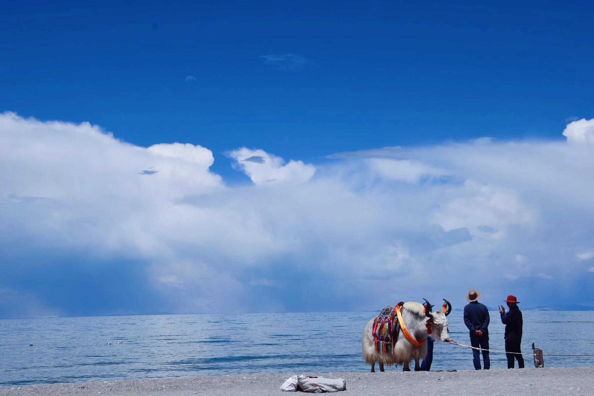
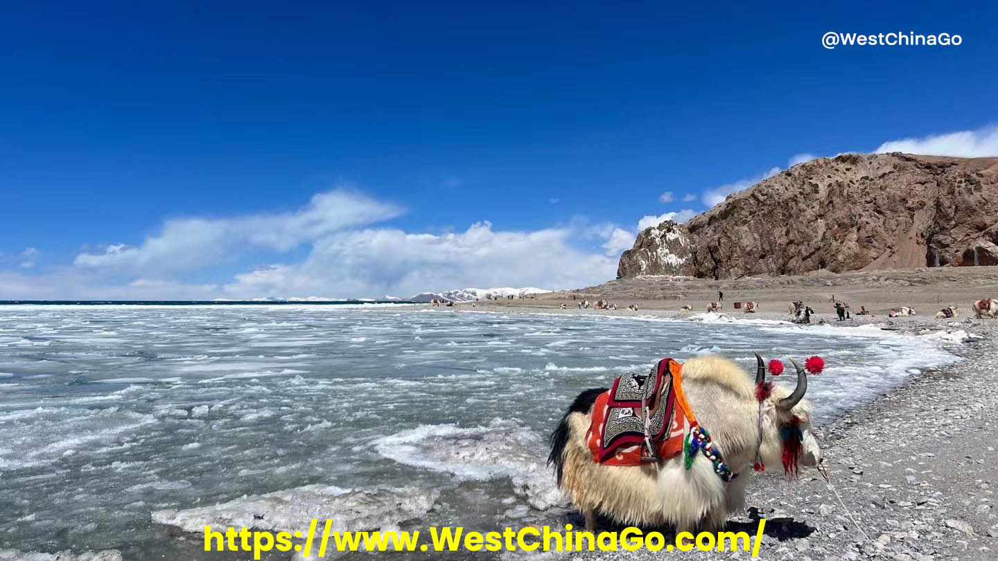
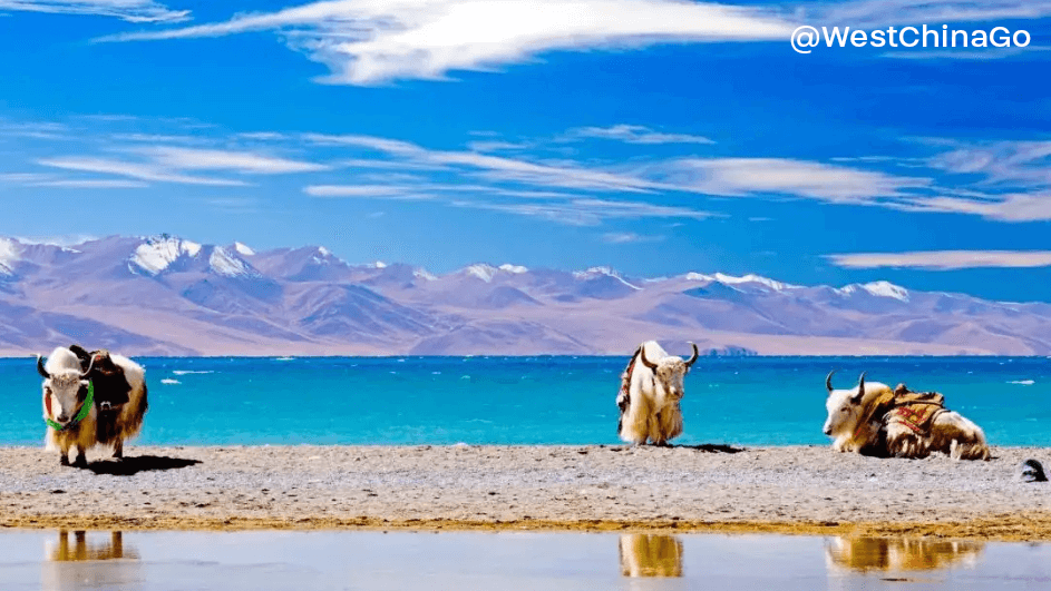
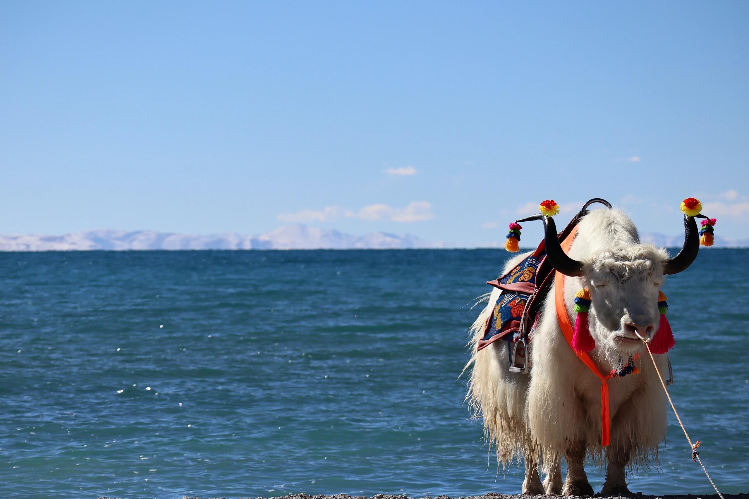
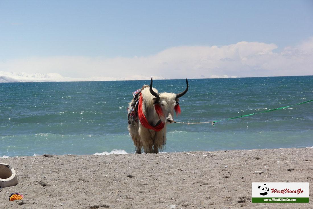
The lake’s pristine environment is home to diverse wildlife, including migratory birds, wild yaks, and Tibetan antelopes. These sightings, combined with the dramatic landscapes of towering mountains and expansive skies, make Namtso a dream destination for nature lovers and photographers.
Gateway to Tibetan Nomadic Life
Around the lake, you’ll find nomadic communities living in traditional tents, grazing their livestock on the highland pastures. Engaging with these locals provides a glimpse into the enduring lifestyle and warm hospitality of Tibetan culture.
Why Visit Namtso Lake?
Namtso Lake is more than just a scenic spot—it’s a journey into the soul of Tibet. Its awe-inspiring beauty, spiritual essence, and cultural richness make it an unmissable stop for those seeking an authentic Tibetan adventure.
Discover the magic of Namtso Lake and create memories that will stay with you forever.
Namtso Lake Video
Namtso Lake Photo

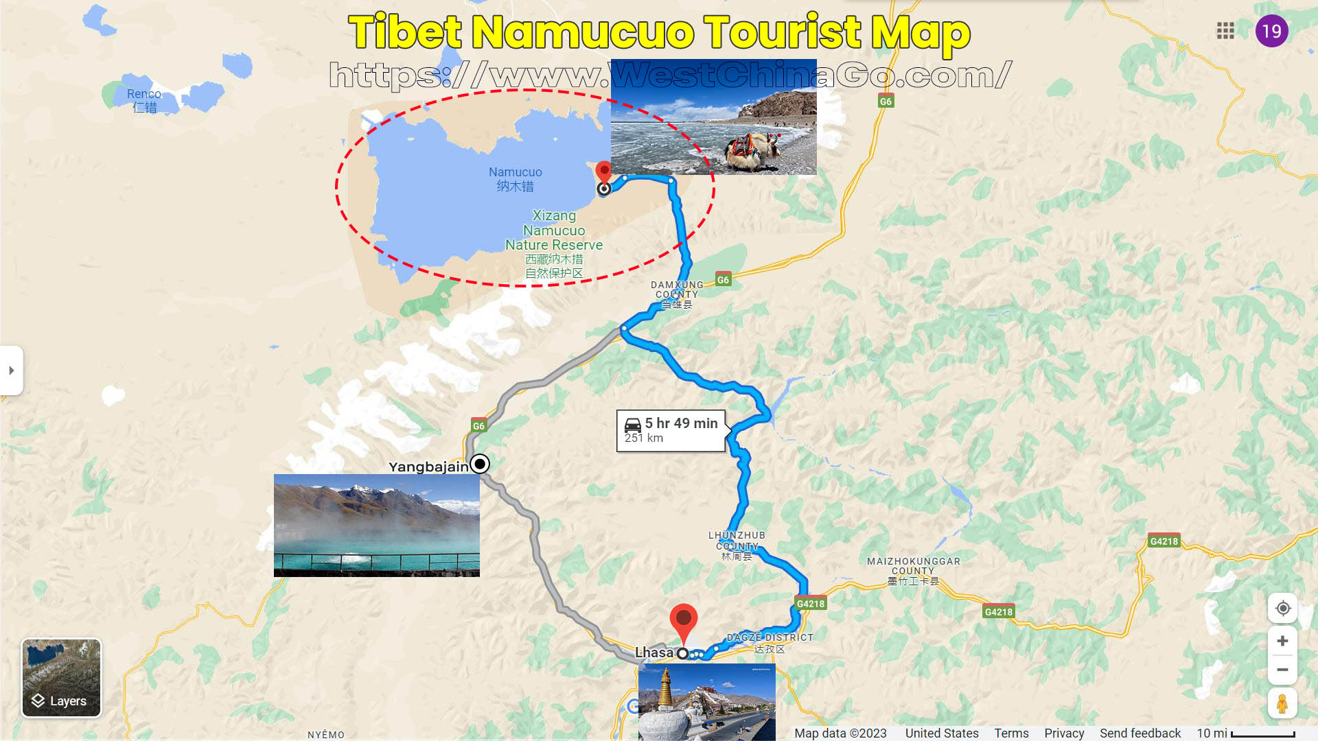
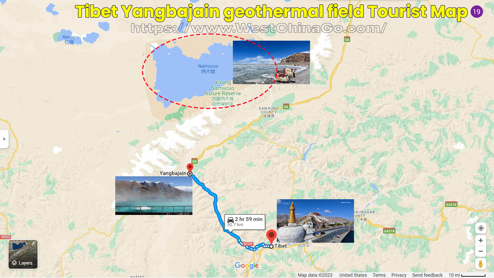
Namtso Lake Tourist Map
Namtso Lake Tour Package
6 Days Tibet Tour
- lhasa city tour
- potala place +sera monastery +norbulinka…
- Namtso Lake
Namtso Lake Travel Guide
Namtso Day Tour
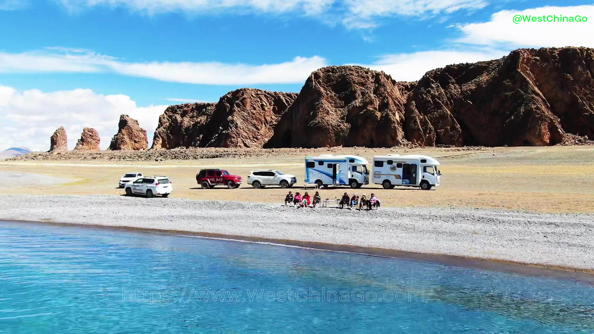
WestChinaGo offer one-day join in tours to Namtso, usually departing in the morning, arriving in 3-4 hours, and returning on the same road after 2-3 hours of play. If you don’t want to charter a car, you can only choose this way, which is also the conventional way to play Namtso. If you don’t want to follow the crowd, you can charter a car or find someone to carpool in Lhasa. The route is the same, but the advantage is that you can travel freely and stay overnight by the lake.
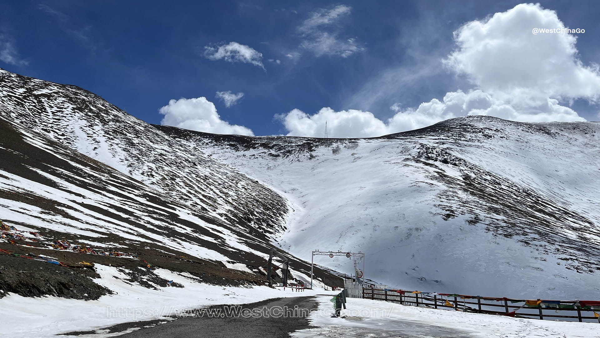
Nagenla Mountain Pass
Coming out of Dangxiong County, passing through the Nagenla Mountain Pass at an altitude of 5,190 meters, you can see the blue water from a distance. There are two huge stones standing side by side on the left and one right by the lake. They are the welcome stones of Namtso, also known as the husband and wife stones. It is said that they are the door gods of Namtso. According to legend, Namtso is the goddess who is in charge of the wealth of the grasslands in northern Tibet. If traders want to go out to do business, they must first come here to pray for the blessing of the goddess to ensure a prosperous business. Therefore, this stone is also called the God of Wealth Stone.
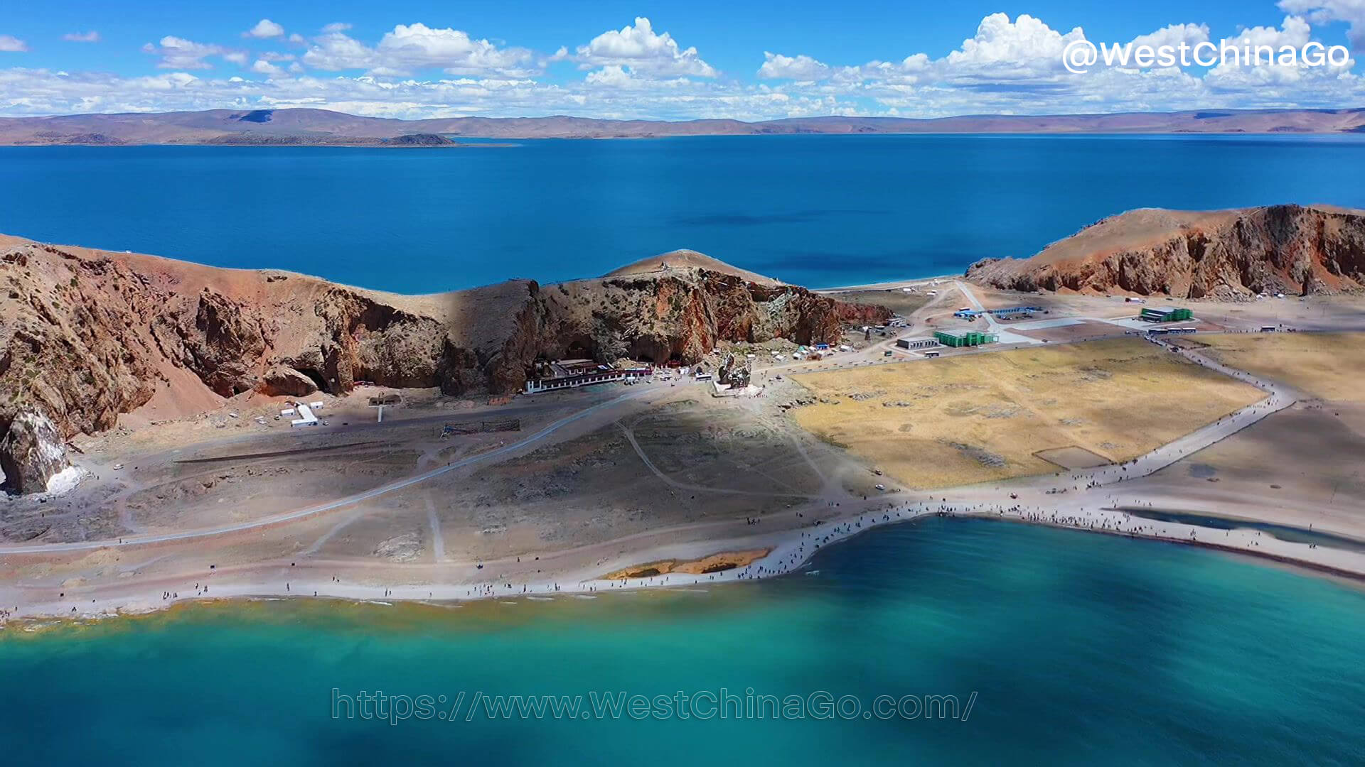
Accommodation
There are a number of prefabricated houses built next to the Tashi Peninsula, including restaurants and inns. This is the place where board and lodging are provided by the Namtso Lake. If you come to Namtso by chartered car, you can stay here for one night. You can enjoy the beauty of the setting sun at dusk, or get up early to welcome the sunrise on the Tashi Peninsula, and look up at the sky at the Namtso Lake in the middle of the night, and you can even distinguish the outline of the Milky Way.